METAR-TAF
Airports :
Kigali International Airport
Kigali, Rwanda
latitude: 01-58S, longitude: 030-07E, elevation: 1491 m
Current weather observation
The report was made 17 minutes ago, at 19:30 UTC
Wind 5 kt from the West/Northwest
Temperature 23°C
Humidity 50%
Pressure 1020 hPa
Visibility 10 km or more
Few clouds at a height of 2500 ft
METAR: HRYR 201930Z 30005KT 9999 FEW025 23/12 Q1020 NOSIG
Time: 21:47 (19:47 UTC)
Forecast
The report was made 2 hours and 47 minutes ago, at 17:00 UTC
Forecast valid from 20 at 18 UTC to 21 at 24 UTC
Wind 4 kt from the Northeast
Visibility 10 km or more
Scattered clouds at a height of 2500 ft
Becoming
from 21 at 08 UTC to 21 at 10 UTC
from 21 at 08 UTC to 21 at 10 UTC
Wind 10 kt from the South
Becoming
from 21 at 18 UTC to 21 at 20 UTC
from 21 at 18 UTC to 21 at 20 UTC
Wind 4 kt from the North/Northeast
TAF: HRYR 201700Z 2018/2124 04004KT 9999 SCT025 BECMG 2108/2110 17010KT BECMG 2118/2120 02004KT
Weather observations and forecasts of more than 4000 airports (METAR and TAF reports).
The available stations are represented by yellow and red dots on the map.
Hover mouse over dot to see the name of the station.
Then click to see weather observations and forecasts.
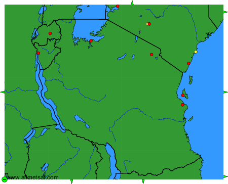
To change the map : click on the green buttons with a black cross to zoom in, on the green button with a dash to zoom out, or on the green arrows for adjacent maps.