METAR-TAF
Airports :
Fort Knox
Alton / St. Louis
Anderson
Andrews
Asheville
Ashland
Athens
Bellefontaine
Belleville
Bloomington
Bloomington / Normal
Blytheville
Blytheville
Bowling Green
Bristol / Johnson / Kingsport
Cahokia / St. Louis
Cairo
Cape Girardeau
Carbondale / Murphysboro
Carmi
Centralia
Champaign / Urbana
Chattanooga
Cincinnati
Clarksville
Clemson
Columbus
Columbus-Bolton
Columbus-John Glenn
Columbus-OSU
Columbus-Rickenbacker
Corinth
Covington
Crawfordsville
Crossville
Dalton
Danville
Danville
Dayton
Dayton
Dayton
Decatur
Decatur
Delaware
Dyersburg
Effingham
Evansville
Fairfield
Fayetteville
Flemingsburg
Flora
Fort Knox
Fort Wayne
Frankfort
Franklin
Gatlinburg
Glasgow
Greenville
Greenville
Hamilton
Harrisburg
Henderson
Hopkinsville
Huntington
Huntsville
Huntsville
Indianapolis
Indianapolis
Indianapolis
Indianapolis
Jackson
Jackson
Jacksonville
Jasper County
Knoxville
Knoxville
Kokomo
Lafayette
Lancaster
Lawrenceville
Lexington
Lima
Lincoln
Litchfield
London
Louisville
Louisville
Madison
Malden
Mansfield
Marion
Marion
Mattoon / Charleston
Memphis
Metropolis
Millington
Monticello
Morristown
Mount Carmel
Mount Vernon
Muncie
Murray
Muscle Shoals
Nashville
Nashville
Newark
Oak Ridge
Olive Branch
Olney-Noble
Owensboro
Paducah
Paris
Paris
Parsons
Peoria
Peru
Pickens
Pikeville
Pontiac
Rantoul
Redstone Arsenal
Robinson
Salem
Shelbyville
Shelbyville
Sikeston
Smyrna
Somerset
Sparta
Springfield
Springfield
Taylorville
Terre Haute
Versailles
Wapakoneta
Washington
West Memphis
Wilmington
Winchester
Wise
Tennessee, Kentucky
Alabama
Arkansas
Delaware
Georgia
Illinois
Indiana
Maryland
Mississippi
Missouri
North America
North Carolina
Ohio
South Carolina
Virginia
Godman Army Airfield Fort Knox, Kentucky, United States
latitude: 37-54N, longitude: 085-58W, elevation: 754 ft
Current weather observation The report was made 24 minutes ago, at 09:07 UTC
Wind 8 mph from the South
Temperature 73 °F
Humidity 89 %
Pressure 29.75 in. Hg
Visibility: 10 miles
Broken clouds at a height of 2900 ft Overcast at a height of 8000 ft
METAR: KFTK 010907Z AUTO 18007KT 10SM BKN029 OVC080 23/21 A2975 RMK AO2 LTG DSNT SW-NW CIG 029V080 SLP068
Time: 05:31 (09:31 UTC) Forecast The report was made 14 hours and 31 minutes ago, at 19:00 UTC
Forecast valid from 31 at 19 UTC to 02 at 01 UTC
Wind 10 mph from the South/Southeast
Visibility 6.2 miles or more
Scattered clouds at a height of 4500 ft Broken clouds at a height of 12000 ft Overcast at a height of 20000 ft
Becoming
Wind 7 mph from the Southeast
Visibility 6.2 miles or more
Scattered clouds at a height of 2500 ft Broken clouds at a height of 8000 ft Overcast at a height of 20000 ft
showers in vicinity
Temporary
Visibility: 29527 ft
Broken clouds at a height of 2500 ft Overcast at a height of 8000 ft
light rain showers
Becoming
Wind 12 mph from the South/Southeast
Visibility 6.2 miles or more
Broken clouds at a height of 1500 ft, Cumulonimbus. Overcast at a height of 5000 ft
thunderstorm in vicinity
Temporary
Visibility: 15748 ft
Overcast at a height of 1200 ft, Cumulonimbus.
thunderstorm, rain
Becoming
Wind 14 mph from the South
Visibility: 29527 ft
Broken clouds at a height of 2000 ft, Cumulonimbus. Overcast at a height of 20000 ft
light rain showers, thunderstorm in vicinity
Temporary
Wind 14 mph from the South/Southwest with gusts up to 25 mph
Visibility: 1020 ft
Overcast at a height of 1500 ft, Cumulonimbus.
thunderstorm, rain
TAF: KFTK 311900Z 3119/0201 15009KT 9999 SCT045 BKN120 OVC200 QNH2988INS BECMG 3123/3124 14006KT 9999 VCSH SCT025 BKN080 OVC200 QNH2972INS TEMPO 0100/0104 9000 -SHRA BKN025 OVC080 BECMG 0108/0109 16010KT 9999 VCTS BKN015CB OVC050 QNH2966INS TEMPO 0109/0113 4800 TSRA OVC012CB BECMG 0115/0116 19012KT 9000 -SHRA VCTS BKN020CB OVC200 QNH2961INS TEMPO 0117/0123 21012G22KT 3200 TSRA OVC015CB TX30/3120Z TN20/0111Z LAST NO AMDS AFT 3121 NEXT 0311
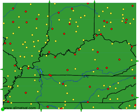
Weather observations and forecasts of more than 4000 airports (METAR and TAF reports).
The available stations are represented by yellow and red dots on the map.
Hover mouse over dot to see the name of the station.
Then click to see weather observations and forecasts.
To change the map : click on the green buttons with a black cross to zoom in, on the green button with a dash to zoom out, or on the green arrows for adjacent maps.