METAR-TAF
Airports :
Chittagong
Agartala
Aizawl
Alor Setar
Bangkok
Bangkok-Suvarnabhumi
Buriram
Butterworth
Cam Ranh
Cần Thơ
Chiang Mai
Chiang Rai
Chittagong
Chumphon
Da Nang
Guangzhou
Haikou
Hanoi
Hat Yai
Ho Chi Minh City
Hong Kong
Hua Hin
Huế
Khon Kaen
Ko Samui
Kota Bharu
Krabi
Kuala Terengganu
Lampang
Langkawi
Loei
Luang Namtha
Luang Prabang
Macau
Mae Hong Son
Mae Sot
Mandalay
Nakhon Phanom
Nakhon Ratchasima
Nakhon Si Thammarat
Nan
Nanning
Narathiwat
Pakxe
Pattani
Pattaya-Rayong
Penang
Phetchabun
Phitsanulok
Phnom Penh
Phrae
Phuket
Phú Quốc
Ranong
Roi Et
Sakon Nakhon
Sanya
Savannakhet
Shenzhen
Siem Reap
Songkhla
Sukhothai
Surat Thani
Tak
Trang
Trat
Ubon Ratchathani
Udon Thani
Vientiane
Yangon
Thailand, Cambodia, Laos, Vietnam
Asia
Bangladesh
Bhutan
China
China, East
Hong Kong
India
Indian Ocean islands
India, Northeast
Indonesia
Macau
Malaysia
Myanmar
Nepal
Philippines
Sri Lanka
Shah Amanat International Airport Chittagong, Bangladesh
latitude: 22-16N, longitude: 091-49E, elevation: 4 m
Current weather observation The report was made 53 minutes ago, at 02:00 UTC
Wind 4 kt from the North/Northeast
Temperature 28 °C
Humidity 79 %
Pressure 1011 hPa
Visibility: 4500 m
Scattered clouds at a height of 13000 ft
haze
METAR: VGEG 080200Z 03004KT 4500 HZ SCT130 28/24 Q1011 NOSIG
Time: 08:53 (02:53 UTC) Forecast The report was made 3 hours and 53 minutes ago, at 23:00 UTC
Forecast valid from 08 at 00 UTC to 09 at 06 UTC
Wind 14 kt from the East with gusts up to 28 kt
Visibility: 2000 m
Broken clouds at a height of 800 ft Few clouds at a height of 2700 ft, Cumulonimbus. Overcast at a height of 8000 ft
thunderstorm, rain
Becoming
Wind 10 kt from the West
Visibility: 5000 m
Scattered clouds at a height of 2600 ft Broken clouds at a height of 11000 ft
haze
Becoming
Wind 7 kt from the West/Northwest
Visibility: 4000 m
Few clouds at a height of 1700 ft Scattered clouds at a height of 11000 ft
haze
Temporary
Wind 13 kt from the East with gusts up to 28 kt
Visibility: 2000 m
Broken clouds at a height of 800 ft Few clouds at a height of 2700 ft, Cumulonimbus. Overcast at a height of 9000 ft
thunderstorm, rain
Becoming
Wind 13 kt from the Northwest
Visibility: 5000 m
Few clouds at a height of 1700 ft Scattered clouds at a height of 11000 ft
haze
TAF: VGEG 072300Z 0800/0906 09014G28KT 2000 TSRA BKN008 FEW027CB OVC080 BECMG 0805/0807 27010KT 5000 HZ SCT026 BKN110 BECMG 0816/0818 30007KT 4000 HZ FEW017 SCT110 TEMPO 0821/0901 10013G28KT 2000 TSRA BKN008 FEW027CB OVC090 BECMG 0902/0904 31013KT 5000 HZ FEW017 SCT110
Weather observations and forecasts of more than 4000 airports (METAR and TAF reports).
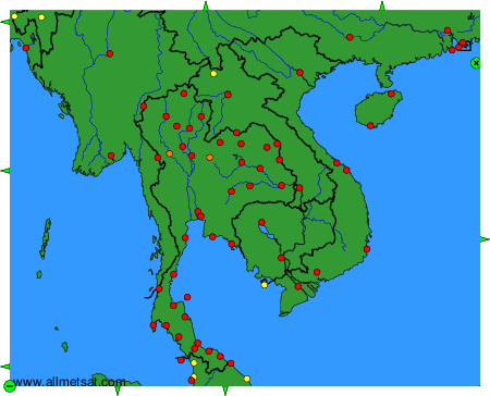
The available stations are represented by yellow and red dots on the map.
Hover mouse over dot to see the name of the station.
Then click to see weather observations and forecasts.
To change the map : click on the green buttons with a black cross to zoom in, on the green button with a dash to zoom out, or on the green arrows for adjacent maps.
