METAR-TAF
Airports :
Mostépha Ben Boulaid Airport
Batna, Algeria
latitude: 35-33N, longitude: 006-11E, elevation: 1052 m
Current weather observation
The report was made 2 hours and 31 minutes ago, at 00:00 UTC
Wind 6 kt from the East/Southeast
Temperature 10°C
Humidity 87%
Pressure 1010 hPa
Visibility 10 km or more
Scattered clouds at a height of 2000 ft
Scattered clouds at a height of 10000 ft
Scattered clouds at a height of 10000 ft
METAR: DABT 210000Z 11006KT 9999 SCT020 SCT100 10/08 Q1010
Time: 03:31 (02:31 UTC)
Forecast
The report was made 3 hours and 31 minutes ago, at 23:00 UTC
Forecast valid from 21 at 00 UTC to 21 at 24 UTC
Wind 8 kt from the West/Northwest
Visibility 10 km or more
Scattered clouds at a height of 2300 ft
Broken clouds at a height of 4000 ft
Broken clouds at a height of 4000 ft
Probability 30% :
Temporary
from 21 at 00 UTC to 21 at 14 UTC
from 21 at 00 UTC to 21 at 14 UTC
Few clouds at a height of 2000 ft, Cumulonimbus.
Broken clouds at a height of 3000 ft
Broken clouds at a height of 3000 ft
Temporary
from 21 at 14 UTC to 21 at 24 UTC
from 21 at 14 UTC to 21 at 24 UTC
Visibility: 3000 m
Few clouds at a height of 1500 ft, Cumulonimbus.
Broken clouds at a height of 2300 ft
Broken clouds at a height of 2300 ft
thunderstorm, light rain
TAF: DABT 202300Z 2100/2124 30008KT 9999 SCT023 BKN040 PROB30 TEMPO 2100/2114 FEW020CB BKN030 TEMPO 2114/2124 3000 -TSRA FEW015CB BKN023
Weather observations and forecasts of more than 4000 airports (METAR and TAF reports).
The available stations are represented by yellow and red dots on the map.
Hover mouse over dot to see the name of the station.
Then click to see weather observations and forecasts.
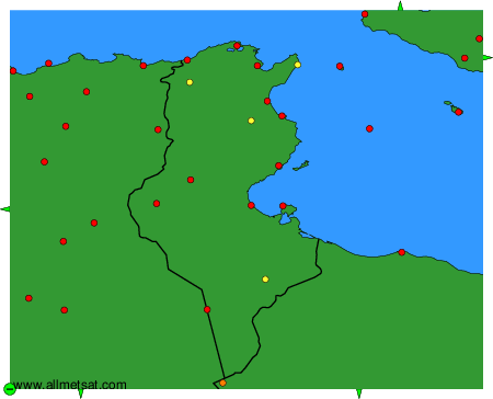
To change the map : click on the green buttons with a black cross to zoom in, on the green button with a dash to zoom out, or on the green arrows for adjacent maps.