METAR-TAF
Airports :
Naval Air Station Sigonella
Sigonella, Italy
latitude: 37-24N, longitude: 014-55E, elevation: 22 m
Current weather observation
Scattered clouds at a height of 2500 ft
Broken clouds at a height of 6000 ft
METAR: LICZ 171155Z 05017KT 6000 -RA FEW020TCU SCT025 BKN060 15/13 Q1007 RMK BKN VIS MIN 6000 WIND THR28 /////KT WIND THR10 /////KT A2975 WHT
Time: 13:43 (12:43 UTC)
Forecast
Broken clouds at a height of 6000 ft
from 17 at 12 UTC to 17 at 21 UTC
Scattered clouds at a height of 2500 ft
Broken clouds at a height of 3000 ft
from 17 at 12 UTC to 17 at 18 UTC
Broken clouds at a height of 1800 ft
Broken clouds at a height of 3000 ft
from 17 at 18 UTC to 17 at 20 UTC
Scattered clouds at a height of 6000 ft
from 18 at 01 UTC to 18 at 06 UTC
Scattered clouds at a height of 2000 ft
TAF: LICZ 171100Z 1712/1812 06020KT 9999 SCT020 BKN060 TEMPO 1712/1721 06015G30KT 7000 RA FEW020CB SCT025 BKN030 PROB40 TEMPO 1712/1718 09015G25KT 5000 TSRA SCT012CB BKN018 BKN030 BECMG 1718/1720 10005KT SCT025 SCT060 PROB40 TEMPO 1801/1806 VRB03KT 5000 BR SCT010 SCT020
Weather observations and forecasts of more than 4000 airports (METAR and TAF reports).
The available stations are represented by yellow and red dots on the map.
Hover mouse over dot to see the name of the station.
Then click to see weather observations and forecasts.
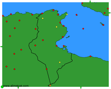
To change the map : click on the green buttons with a black cross to zoom in, on the green button with a dash to zoom out, or on the green arrows for adjacent maps.