METAR-TAF
Airports :
Lublin Airport
Lublin, Poland
latitude: 51-13-55N, longitude: 22-41-25E, elevation: 203 m
Current weather observation
The report was made 21 minutes ago, at 10:00 UTC
Wind 10 kt from the South, varying between South/Southeast and South/Southwest
Temperature 34°C
Humidity 34%
Pressure 1017 hPa
Visibility 10 km or more
no clouds below 1500 m and no cumulonimbus
METAR: EPLB 311000Z 18010KT 150V210 CAVOK 34/16 Q1017
Time: 12:21 (10:21 UTC)
Forecast
The report was made 4 hours and 51 minutes ago, at 05:30 UTC
Forecast valid from 31 at 06 UTC to 01 at 06 UTC
Wind 8 kt from the East/Southeast
Visibility 10 km or more
no clouds below 1500 m and no cumulonimbus
Temporary
from 31 at 12 UTC to 31 at 21 UTC
from 31 at 12 UTC to 31 at 21 UTC
Wind 20 kt from variable directions with gusts up to 40 kt
Visibility: 2000 m
Broken clouds at a height of 6000 ft, Cumulonimbus.
thunderstorm, rain
Probability 40% :
Temporary
from 31 at 13 UTC to 31 at 18 UTC
from 31 at 13 UTC to 31 at 18 UTC
Visibility: 1200 m
Broken clouds at a height of 1400 ft, Cumulonimbus.
thunderstorm, hail
Becoming
from 31 at 15 UTC to 31 at 18 UTC
from 31 at 15 UTC to 31 at 18 UTC
Wind 2 kt from variable directions
TAF: EPLB 310530Z 3106/0106 12008KT CAVOK TEMPO 3112/3121 VRB20G40KT 2000 TSRA BKN060CB PROB40 TEMPO 3113/3118 1200 TSGR BKN014CB BECMG 3115/3118 VRB02KT
Weather observations and forecasts of more than 4000 airports (METAR and TAF reports).
The available stations are represented by yellow and red dots on the map.
Hover mouse over dot to see the name of the station.
Then click to see weather observations and forecasts.
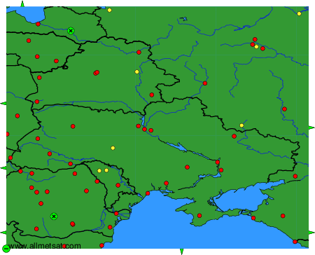
To change the map : click on the green buttons with a black cross to zoom in, on the green button with a dash to zoom out, or on the green arrows for adjacent maps.