METAR-TAF
Airports :
Aurel Vlaicu International Airport
Bucharest Băneasa, Romania
latitude: 44-30N, longitude: 026-08E, elevation: 90 m
Current weather observation
The report was made 33 minutes ago, at 00:30 UTC
Wind 4 kt from the West/Northwest, varying between West and North/Northwest
Temperature 16°C
Humidity 82%
Pressure 1013 hPa
Visibility 10 km or more
no clouds below 1500 m and no cumulonimbus
METAR: LRBS 200030Z 30004KT 270V330 CAVOK 16/13 Q1013 NOSIG
Time: 04:03 (01:03 UTC)
Forecast
The report was made 2 hours and 3 minutes ago, at 23:00 UTC
Forecast valid from 20 at 00 UTC to 20 at 24 UTC
Wind 4 kt from variable directions
Visibility 10 km or more
no clouds below 1500 m and no cumulonimbus
Becoming
from 20 at 08 UTC to 20 at 10 UTC
from 20 at 08 UTC to 20 at 10 UTC
Wind 10 kt from the North/Northwest
Probability 30% :
Temporary
from 20 at 11 UTC to 20 at 18 UTC
from 20 at 11 UTC to 20 at 18 UTC
Visibility: 5000 m
Scattered clouds at a height of 3000 ft, Cumulonimbus.
thunderstorm, light rain
Becoming
from 20 at 19 UTC to 20 at 21 UTC
from 20 at 19 UTC to 20 at 21 UTC
Wind 4 kt from variable directions
TAF: LRBS 192300Z 2000/2024 VRB04KT CAVOK BECMG 2008/2010 33010KT PROB30 TEMPO 2011/2018 5000 -TSRA SCT030CB BECMG 2019/2021 VRB04KT
Weather observations and forecasts of more than 4000 airports (METAR and TAF reports).
The available stations are represented by yellow and red dots on the map.
Hover mouse over dot to see the name of the station.
Then click to see weather observations and forecasts.
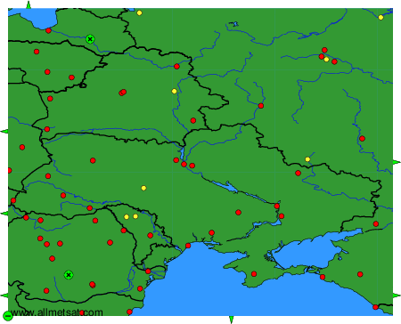
To change the map : click on the green buttons with a black cross to zoom in, on the green button with a dash to zoom out, or on the green arrows for adjacent maps.