METAR-TAF
Airports :
Anapa Airport
Anapa, Russia
latitude: 44-54N, longitude: 037-19E, elevation: 53 m
Current weather observation
The report was made 15 minutes ago, at 18:30 UTC
Wind 6 kt from the East
Temperature 20°C
Humidity 68%
Pressure 1007 hPa
Visibility 10 km or more
no clouds below 1500 m and no cumulonimbus
METAR: URKA 021830Z 08003MPS CAVOK 20/14 Q1007 R03/010065 NOSIG RMK QFE751/1002
Time: 22:45 (18:45 UTC)
Forecast
The report was made 2 hours and 0 minutes ago, at 16:45 UTC
Forecast valid from 02 at 18 UTC to 03 at 18 UTC
Wind 6 kt from the East/Northeast with gusts up to 16 kt
Visibility 10 km or more
no clouds below 1500 m and no cumulonimbus
Temporary
from 02 at 18 UTC to 03 at 05 UTC
from 02 at 18 UTC to 03 at 05 UTC
Wind 6 kt from the East/Southeast with gusts up to 16 kt
From 03 at 0500 UTC
Wind 12 kt from the South/Southeast with gusts up to 23 kt
Visibility 10 km or more
Scattered clouds at a height of 3000 ft, Cumulonimbus.
Temporary
from 03 at 06 UTC to 03 at 18 UTC
from 03 at 06 UTC to 03 at 18 UTC
Wind 12 kt from the South/Southwest with gusts up to 23 kt
Visibility: 6000 m
Broken clouds at a height of 2000 ft, Cumulonimbus.
thunderstorm, light rain
TAF: URKA 021645Z 0218/0318 07003G08MPS CAVOK TEMPO 0218/0305 12003G08MPS FM030500 16006G12MPS 9999 SCT030CB TEMPO 0306/0318 20006G12MPS 6000 -TSRA BKN020CB
Weather observations and forecasts of more than 4000 airports (METAR and TAF reports).
The available stations are represented by yellow and red dots on the map.
Hover mouse over dot to see the name of the station.
Then click to see weather observations and forecasts.
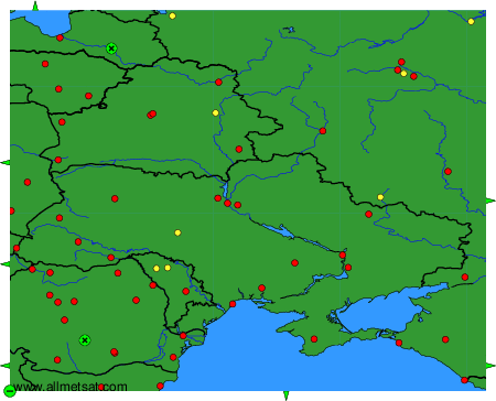
To change the map : click on the green buttons with a black cross to zoom in, on the green button with a dash to zoom out, or on the green arrows for adjacent maps.