METAR-TAF
Airports :
Cedar City
Blanding
Brigham City
Bryce Canyon
Cedar City
Colorado City
Cortez
Craig
Delta
Durango
Ely
Evanston
Farmington
Grand Junction
Hayden
Heber City
Hill AFB
Kemmerer
Logan
Meeker
Milford
Moab
Montrose
Nellis
Ogden
Page
Price
Provo
Rawlins
Rifle
Rock Springs
Salt Lake City
St. George
Sunlight Mountain
Telluride
Tooele
Twin Falls
Vernal
Wendover
Utah
Arizona
Colorado
Idaho
Nevada
New Mexico
North America
Wyoming
Cedar City Regional Airport Cedar City, Utah, United States
latitude: 37-42-24N, longitude: 113-05-48W, elevation: 1715 m
Current weather observation The report was made 46 minutes ago, at 21:53 UTC
Wind 18 kt from the Southwest with gusts up to 27 kt
Temperature 16 °C
Humidity 20 %
Pressure 1015 hPa
Visibility: 16.1 km
Clear sky
METAR: KCDC 042153Z AUTO 22018G27KT 10SM CLR 16/M07 A2996 RMK AO2 PK WND 23030/2143 SLP118 T01561072
Time: 15:39 (22:39 UTC) Forecast The report was made 5 hours and 2 minutes ago, at 17:37 UTC
Forecast valid from 04 at 18 UTC to 05 at 18 UTC
Wind 14 kt from the Southwest with gusts up to 24 kt
Visibility: 10 km
Few clouds at a height of 25000 ft
From 05 at 0300 UTC
Wind 7 kt from the South/Southwest
Visibility: 10 km
Few clouds at a height of 25000 ft
From 05 at 0900 UTC
Wind 10 kt from the North/Northwest
Visibility: 10 km
Broken clouds at a height of 2500 ft
light snow
From 05 at 1500 UTC
Wind 8 kt from the North
Visibility: 10 km
Broken clouds at a height of 5000 ft
light snow showers
TAF: KCDC 041737Z 0418/0518 22014G24KT P6SM FEW250 FM050300 20007KT P6SM FEW250 FM050900 33010KT P6SM -SN BKN025 FM051500 01008KT P6SM -SHSN BKN050
Weather observations and forecasts of more than 4000 airports (METAR and TAF reports).
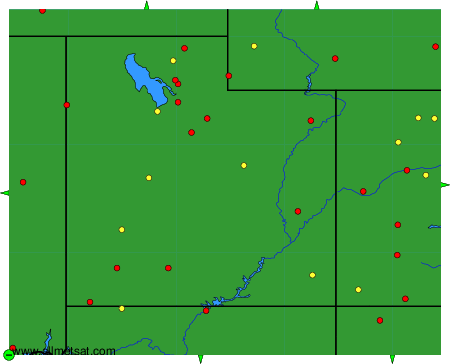
The available stations are represented by yellow and red dots on the map.
Hover mouse over dot to see the name of the station.
Then click to see weather observations and forecasts.
To change the map : click on the green buttons with a black cross to zoom in, on the green button with a dash to zoom out, or on the green arrows for adjacent maps.
