METAR-TAF
Airports :
General José Antonio Anzoátegui International Airport
Barcelona, Venezuela
latitude: 10-07N, longitude: 064-41W, elevation: 7 m
Current weather observation
The report was made 8 hours and 37 minutes ago, at 00:00 UTC
Calm wind
Temperature 27°C
Pressure 1012 hPa
Visibility 10 km or more
Scattered clouds at a height of 1600 ft
METAR: SVBC 210000Z 00000KT 9999 SCT016 27/// Q1012
Time: 04:37 (08:37 UTC)
Forecast
The report was made 16 hours and 37 minutes ago, at 16:00 UTC
Forecast valid from 20 at 18 UTC to 21 at 18 UTC
Wind 5 kt from the East/Northeast
Visibility 10 km or more
Temporary
from 20 at 18 UTC to 20 at 22 UTC
from 20 at 18 UTC to 20 at 22 UTC
Wind 8 kt from the East
Visibility: 9000 m
Scattered clouds at a height of 1000 ft
Scattered clouds at a height of 4000 ft
Scattered clouds at a height of 4000 ft
From 20 at 2300 UTC
Visibility 10 km or more
Few clouds at a height of 1000 ft
Scattered clouds at a height of 8000 ft
Scattered clouds at a height of 8000 ft
TAF: SVBC 201600Z 2018/2118 07005KT 9999 SCT010TX36/2019Z TN23/2107Z TEMPO 2018/2022 08008KT 9000 -VCDZ SCT010 SCT040 FM20230009003KT 9999 FEW010 SCT080
Weather observations and forecasts of more than 4000 airports (METAR and TAF reports).
The available stations are represented by yellow and red dots on the map.
Hover mouse over dot to see the name of the station.
Then click to see weather observations and forecasts.
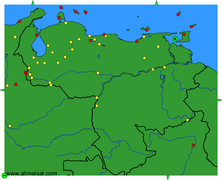
To change the map : click on the green buttons with a black cross to zoom in, on the green button with a dash to zoom out, or on the green arrows for adjacent maps.