METAR-TAF
Airports :
Queen Beatrix International Airport
Aruba, Aruba
latitude: 12-30N, longitude: 070-01W, elevation: 18 m
Current weather observation
The report was made 24 minutes ago, at 23:00 UTC
Wind 22 kt from the East
Temperature 28°C
Humidity 79%
Pressure 1011 hPa
Visibility 10 km or more
Few clouds at a height of 1800 ft
METAR: TNCA 312300Z 08022KT 9999 FEW018 28/24 Q1011 NOSIG
Time: 19:24 (23:24 UTC)
Forecast
The report was made 5 hours and 24 minutes ago, at 18:00 UTC
Forecast valid from 31 at 18 UTC to 01 at 18 UTC
Wind 23 kt from the East
Visibility 10 km or more
Few clouds at a height of 2000 ft
Temporary
from 01 at 04 UTC to 01 at 12 UTC
from 01 at 04 UTC to 01 at 12 UTC
Scattered clouds at a height of 1500 ft
Broken clouds at a height of 1800 ft
Broken clouds at a height of 1800 ft
Becoming
from 01 at 12 UTC to 01 at 14 UTC
from 01 at 12 UTC to 01 at 14 UTC
Wind 24 kt from the East with gusts up to 34 kt
TAF: TNCA 311800Z 3118/0118 08023KT 9999 FEW020 TEMPO 0104/0112 SCT015 BKN018 BECMG 0112/0114 10024G34KT
Weather observations and forecasts of more than 4000 airports (METAR and TAF reports).
The available stations are represented by yellow and red dots on the map.
Hover mouse over dot to see the name of the station.
Then click to see weather observations and forecasts.
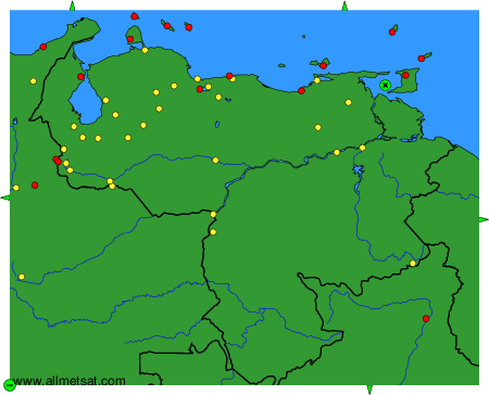
To change the map : click on the green buttons with a black cross to zoom in, on the green button with a dash to zoom out, or on the green arrows for adjacent maps.