METAR-TAF
Airports :
Port of Spain
Acarigua
Arauca
Aruba
Barcelona
Barinas
Barquisimeto
Barrancabermeja
Boa Vista
Bonaire
Bucaramanga
Caracas
Ciudad Bolívar
Ciudad Guayana
Coro
Cúcuta
Cumaná
Curaçao
El Vigia
Guanare
Guasdualito
Isla Margarita
La Carlota
La Fría
Maracaibo
Maracay
Maturín
Mene Grande
Mérida
Paraguaná
Port of Spain
Puerto Ayacucho
Puerto Cabello
Puerto Carreño
Riohacha
San Antonio del Táchira
San Cristóbal
San Felipe
San Fernando de Apure
San Juan De Los Morros
Santa Bárbara del Zulia
Santa Elena de Uairén
Santo Domingo
San Tomé
Scarborough
St. George's
Valencia
Valera
Valledupar
Villavicencio
Venezuela
Brazil
Colombia
Dominican Republic
Guyana, Suriname, French Guiana
Haiti
Lesser Antilles
Puerto Rico
South America
Trinidad and Tobago
Piarco International Airport Port of Spain, Trinidad, Trinidad and Tobago
latitude: 10-37N, longitude: 061-21W, elevation: 12 m
Current weather observation The report was made 49 minutes ago, at 08:00 UTC
Wind 3 kt from the East/Southeast
Temperature 25 °C
Humidity 89 %
Pressure 1014 hPa
Visibility 10 km or more
Few clouds at a height of 1600 ft
METAR: TTPP 260800Z 12003KT 9999 FEW016 25/23 Q1014 NOSIG
Time: 04:49 (08:49 UTC) Forecast The report was made 4 hours and 49 minutes ago, at 04:00 UTC
Forecast valid from 26 at 06 UTC to 27 at 06 UTC
Wind North
Visibility 10 km or more
Few clouds at a height of 1600 ft
Becoming
Wind 12 kt from the East/Southeast
Visibility 10 km or more
Scattered clouds at a height of 2200 ft
Probability 30% :
Temporary
Visibility: 5000 m
Few clouds at a height of 1200 ft, Cumulonimbus. Broken clouds at a height of 1600 ft
rain showers
Becoming
Wind North
Visibility 10 km or more
Few clouds at a height of 1600 ft
TAF: TTPP 260400Z 2606/2706 00000KT 9999 FEW016 BECMG 2612/2614 12012KT 9999 SCT022 PROB30 TEMPO 2615/2620 5000 SHRA FEW012CB BKN016 BECMG 2700/2702 00000KT 9999 FEW016
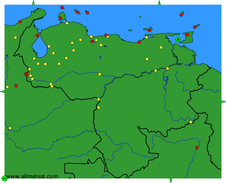
Weather observations and forecasts of more than 4000 airports (METAR and TAF reports).
The available stations are represented by yellow and red dots on the map.
Hover mouse over dot to see the name of the station.
Then click to see weather observations and forecasts.
To change the map : click on the green buttons with a black cross to zoom in, on the green button with a dash to zoom out, or on the green arrows for adjacent maps.