METAR-TAF
Airports :
Andrews Field
Camp Springs, Maryland, United States
latitude: 38-49N, longitude: 076-51W, elevation: 282 ft
Current weather observation
Broken clouds at a height of 2300 ft
METAR: KADW 162116Z 15013KT 10SM FEW012 BKN023 18/16 A2937 RMK AO2A LTG DSNT S RAE2058DZB2058E16 PRESFR SLP951 $
Time: 17:47 (21:47 UTC)
Forecast
from 16 at 10 UTC to 16 at 12 UTC
from 16 at 13 UTC to 16 at 14 UTC
from 16 at 16 UTC to 16 at 17 UTC
from 16 at 19 UTC to 16 at 21 UTC
from 17 at 00 UTC to 17 at 01 UTC
from 17 at 03 UTC to 17 at 04 UTC
from 17 at 05 UTC to 17 at 06 UTC
from 17 at 09 UTC to 17 at 10 UTC
from 17 at 12 UTC to 17 at 13 UTC
TAF: KADW 160900Z 1609/1715 16012G25KT 8000 -SHRA OVC005 510154 QNH2969INS TEMPO 1610/1612 9000 -DZ OVC003 BECMG 1613/1614 18015G35KT 6000 -SHRA VCTS OVC008CB QNH2962INS BECMG 1616/1617 18020G35KT 6000 TSRA OVC015CB QNH2953INS TEMPO 1619/1621 15035G50KT 3200 +TSRA BKN005CB BECMG 1700/1701 30015G35KT 8000 -SHRA OVC020 510008 550809 QNH2930INS BECMG 1703/1704 28015G20KT 8000 -DZ BKN020 QNH2934INS BECMG 1705/1706 26015G25KT 9999 NSW SCT030 QNH2950INS BECMG 1709/1710 27015G25KT 9999 BKN060 QNH2964INS BECMG 1712/1713 24010G15KT 9999 OVC050 610501 QNH2975INS TX22/1621Z TN01/1708Z
Weather observations and forecasts of more than 4000 airports (METAR and TAF reports).
The available stations are represented by yellow and red dots on the map.
Hover mouse over dot to see the name of the station.
Then click to see weather observations and forecasts.
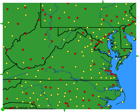
To change the map : click on the green buttons with a black cross to zoom in, on the green button with a dash to zoom out, or on the green arrows for adjacent maps.