METAR-TAF
Airports :
Missoula
Boise
Bozeman
Butte
Caldwell
Cardston
Challis
Coeur d'Alene
Creston
Cut Bank
Dillon
Driggs
Grangeville
Great Falls
Great Falls
Hailey
Havre
Helena
Idaho Falls
Jackson
Kalispell Glacier Park
Lewiston
Lewistown
Livingston
Lowell
McCall
Milk River
Missoula
Mountain Home
Mullan Pass Vor
Nampa
Onefour
Ontario
Pullman / Moscow
Rexburg
Salmon
Sandpoint
Stanley
West Yellowstone
Yellowstone Lake
Montana, West
Alberta
British Columbia
Idaho
Montana, East
North America
Oregon
Saskatchewan
Washington
Wyoming
Missoula International Airport Missoula, Montana, United States
latitude: 46-55-15N, longitude: 114-05-33W, elevation: 3198 ft
Current weather observation The report was made 8 minutes ago, at 12:53 UTC
Wind 7 mph from the West
Temperature 46 °F
Humidity 61 %
Pressure 30.05 in. Hg
Visibility: 10 miles
Few clouds at a height of 4300 ft Broken clouds at a height of 5000 ft Overcast at a height of 9000 ft
METAR: KMSO 141253Z 27006KT 10SM FEW043 BKN050 OVC090 08/01 A3005 RMK AO2 SLP181 T00780011
Time: 07:01 (13:01 UTC) Forecast The report was made 1 hour and 41 minutes ago, at 11:20 UTC
Forecast valid from 14 at 12 UTC to 15 at 12 UTC
Wind 13 mph from the West/Southwest with gusts up to 29 mph
Visibility: 6 miles
Few clouds at a height of 3500 ft Overcast at a height of 5000 ft
From 14 at 1700 UTC
Wind 17 mph from the West with gusts up to 29 mph
Visibility: 6 miles
Broken clouds at a height of 5000 ft
From 15 at 0300 UTC
Wind 8 mph from the Northwest
Visibility: 6 miles
Broken clouds at a height of 10000 ft
From 15 at 0600 UTC
Wind 6 mph from variable directions
Visibility: 6 miles
Broken clouds at a height of 5000 ft
From 15 at 1000 UTC
Wind 8 mph from the Northwest
Visibility: 6 miles
Broken clouds at a height of 5000 ft
TAF: KMSO 141120Z 1412/1512 25011G25KT P6SM FEW035 OVC050 FM141700 28015G25KT P6SM BKN050 FM150300 31007KT P6SM BKN100 FM150600 VRB05KT P6SM BKN050 FM151000 32007KT P6SM BKN050
Weather observations and forecasts of more than 4000 airports (METAR and TAF reports).
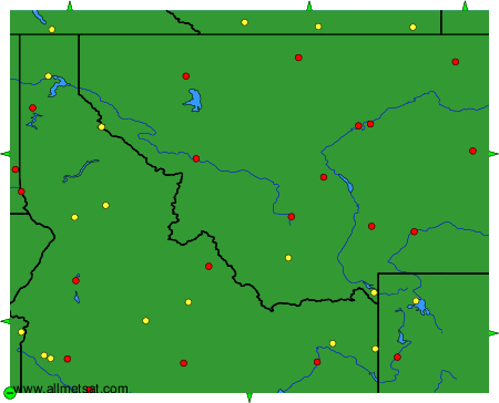
The available stations are represented by yellow and red dots on the map.
Hover mouse over dot to see the name of the station.
Then click to see weather observations and forecasts.
To change the map : click on the green buttons with a black cross to zoom in, on the green button with a dash to zoom out, or on the green arrows for adjacent maps.
