The report was made 5 hours and 38 minutes ago, at 11:03 UTC
Forecast valid from 01 at 12 UTC to 02 at 12 UTC
Wind 12 kt from the Southwest
Visibility 10 km or more
Scattered clouds at a height of 4000 ft Broken clouds at a height of 6000 ft
Temporary from 01 at 12 UTC to 01 at 16 UTC
Wind 17 kt from the West/Southwest with gusts up to 27 kt
Scattered clouds at a height of 3000 ft, Cumulonimbus.
Becoming from 01 at 16 UTC to 01 at 18 UTC
Wind 10 kt from the North/Northeast
Temporary from 01 at 18 UTC to 02 at 02 UTC
Wind 10 kt from the East/Northeast
Temporary from 02 at 02 UTC to 02 at 06 UTC
Wind 12 kt from the East/Southeast
Scattered clouds at a height of 3000 ft, Cumulonimbus.
light rain showers
Temporary from 02 at 06 UTC to 02 at 12 UTC
Wind 35 kt from variable directions
Visibility: 3100 m
Broken clouds at a height of 3000 ft, Cumulonimbus.
thunderstorm, light rain, squalls
TAF: UACC 011103Z 0112/0212 22006MPS 9999 SCT040 BKN060 TX30/0210Z TN15/0123Z TEMPO 0112/0116 24009G14MPS SCT030CB BECMG 0116/0118 02005MPS TEMPO 0118/0202 07005MPS TEMPO 0202/0206 12006MPS -SHRA SCT030CB TEMPO 0206/0212 VRB18MPS 3100 -TSRA SQ BKN030CB
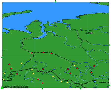
Weather observations and forecasts of more than 4000 airports (METAR and TAF reports).
The available stations are represented by yellow and red dots on the map.
Hover mouse over dot to see the name of the station.
Then click to see weather observations and forecasts.
To change the map : click on the green buttons with a black cross to zoom in, on the green button with a dash to zoom out, or on the green arrows for adjacent maps.