METAR-TAF
Airports :
Omsk Tsentralny Airport
Omsk, Russia
latitude: 54-58N, longitude: 073-18E, elevation: 122 m
Current weather observation
The report was made 26 minutes ago, at 18:30 UTC
Wind 4 kt from the North
Temperature 24°C
Humidity 61%
Pressure 1014 hPa
Visibility 10 km or more
no clouds below 1500 m and no cumulonimbus
METAR: UNOO 291830Z 35002MPS CAVOK 24/16 Q1014 R07/CLRD63 NOSIG RMK QFE752
Time: 00:56 (18:56 UTC)
Forecast
The report was made 2 hours and 6 minutes ago, at 16:50 UTC
Forecast valid from 29 at 18 UTC to 30 at 18 UTC
Wind 6 kt from the West/Northwest
Visibility 10 km or more
Scattered clouds at a height of 3300 ft
Temporary
from 29 at 21 UTC to 30 at 01 UTC
from 29 at 21 UTC to 30 at 01 UTC
Visibility: 3100 m
mist, Shallow fog
Temporary
from 30 at 06 UTC to 30 at 15 UTC
from 30 at 06 UTC to 30 at 15 UTC
Wind 25 kt from variable directions
Visibility: 3100 m
Scattered clouds at a height of 1000 ft
Broken clouds at a height of 3000 ft, Cumulonimbus.
Broken clouds at a height of 3000 ft, Cumulonimbus.
thunderstorm, light rain
TAF: UNOO 291650Z 2918/3018 29003MPS 9999 SCT033 TEMPO 2921/3001 3100 BR MIFG TEMPO 3006/3015 VRB13MPS 3100 -TSRA SCT010 BKN030CB
Weather observations and forecasts of more than 4000 airports (METAR and TAF reports).
The available stations are represented by yellow and red dots on the map.
Hover mouse over dot to see the name of the station.
Then click to see weather observations and forecasts.
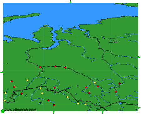
To change the map : click on the green buttons with a black cross to zoom in, on the green button with a dash to zoom out, or on the green arrows for adjacent maps.