METAR-TAF
Airports :
Liberal
Abilene
Abilene
Alamogordo
Alamogordo / Holloman
Albuquerque
Albuquerque
Altus
Altus
Amarillo
Big Spring
Borger
Brownwood
Canadian
Carlsbad
Childress
Ciudad Juárez
Clayton
Clines Corners
Clinton
Clinton / Burns Flat
Clovis
Clovis / Cannon
Coleman
Dalhart
Dumas
El Paso
Fort Bliss
Fort Stockton
Frederick
Gage
Guymon
Hobart
Hobbs
Junction
Las Vegas
Los Alamos
Lubbock
Midland Airpark
Midland Intl.
Odessa
Pampa
Pecos
Perryton
Pine Springs
Plainview
Raton
Roswell
Ruidoso
San Angelo
Santa Fe
Seminole
Snyder
Sonora
Sweetwater
Taos
Tucumcari
Vernon
Wink
Woodward
Texas, West
Colorado
Kansas
Mexico, Northeast
Mexico, Northwest
New Mexico
North America
Oklahoma
Texas, East
Texas, South
Liberal Mid-America Regional Airport Liberal, Kansas, United States
latitude: 37-03N, longitude: 100-58W, elevation: 2883 ft
Current weather observation The report was made 1 hour and 3 minutes ago, at 13:56 UTC
Wind 5 mph from the North
Temperature 79 °F
Humidity 48 %
Pressure 30.09 in. Hg
Visibility: 10 miles
Clear sky
METAR: KLBL 061356Z AUTO 01004KT 10SM CLR 26/14 A3009 RMK AO2 SLP162 T02560144 PNO $
Time: 09:59 (14:59 UTC) Forecast The report was made 3 hours and 39 minutes ago, at 11:20 UTC
Forecast valid from 06 at 12 UTC to 07 at 12 UTC
Wind 6 mph from the Northwest
Visibility: 6 miles
Broken clouds at a height of 22000 ft
From 07 at 0100 UTC
Wind 10 mph from the Southeast
Visibility: 6 miles
Scattered clouds at a height of 24000 ft
Probability 30% from 07 at 03 UTC to 07 at 05 UTC
Visibility: 4 miles
Overcast at a height of 2500 ft, Cumulonimbus.
thunderstorm, light rain
From 07 at 0500 UTC
Wind 9 mph from the East
Visibility: 6 miles
Broken clouds at a height of 22000 ft
Probability 30% from 07 at 05 UTC to 07 at 09 UTC
Visibility: 4 miles
Overcast at a height of 2500 ft, Cumulonimbus.
thunderstorm, light rain,
TAF: KLBL 061120Z 0612/0712 32005KT P6SM BKN220 FM070100 13009KT P6SM SCT240 PROB30 0703/0705 4SM -TSRA OVC025CB FM070500 09008KT P6SM BKN220 PROB30 0705/0709 4SM -TSRA OVC025CB
Weather observations and forecasts of more than 4000 airports (METAR and TAF reports).
The available stations are represented by yellow and red dots on the map.
Hover mouse over dot to see the name of the station.
Then click to see weather observations and forecasts.
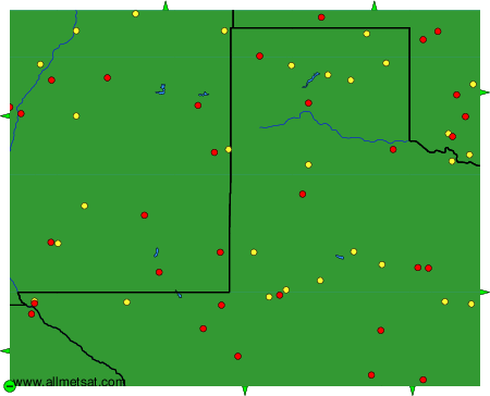
To change the map : click on the green buttons with a black cross to zoom in, on the green button with a dash to zoom out, or on the green arrows for adjacent maps.