METAR-TAF
Airports :
Bozeman
Afton
Baker
Big Piney / Marbleton
Billings
Boulder
Bozeman
Buffalo
Casper
Cheyenne
Cody
Craig
Douglas
Driggs
Erie
Evanston
Fort Collins / Loveland
Fort Morgan
Gillette
Greeley
Greybull
Hayden
Heber City
Jackson
Kemmerer
Kremmling
Lander
Laramie
Livingston
Longmont
Meeker
Pinedale
Rawlins
Riverton
Rock Springs
Saratoga
Sheridan
Spearfish
Steamboat Springs
Torrington
Vernal
West Yellowstone
Worland
Yellowstone Lake
Wyoming
Colorado
Dakota
Idaho
Montana, East
Montana, West
Nebraska
North America
Utah
Bozeman Yellowstone International Airport Bozeman, Montana, United States
latitude: 45-47-17N, longitude: 111-09-39W, elevation: 4474 ft
Current weather observation The report was made 53 minutes ago, at 17:56 UTC
Wind 18 mph from the West/Southwest with gusts up to 26 mph
Temperature 61 °F
Humidity 23 %
Pressure 29.92 in. Hg
Visibility: 10 miles
Clear sky
METAR: KBZN 141756Z 24016G23KT 10SM CLR 16/M05 A2992 RMK AO2 PK WND 21031/1721 SLP114 T01611050 10167 20067 58016
Time: 12:49 (18:49 UTC) Forecast The report was made 1 hour and 8 minutes ago, at 17:41 UTC
Forecast valid from 14 at 18 UTC to 15 at 24 UTC
Wind 17 mph from the West with gusts up to 25 mph
Visibility: 6 miles
Scattered clouds at a height of 8000 ft
From 14 at 2000 UTC
Wind 24 mph from the West/Northwest with gusts up to 35 mph
Visibility: 6 miles
Broken clouds at a height of 10000 ft
From 15 at 0400 UTC
Wind 6 mph from variable directions
Visibility: 6 miles
Scattered clouds at a height of 8000 ft
From 15 at 1400 UTC
Wind 10 mph from the West
Visibility: 6 miles
Scattered clouds at a height of 10000 ft
TAF: KBZN 141741Z 1418/1524 26015G22KT P6SM SCT080 FM142000 30021G30KT P6SM BKN100 FM150400 VRB05KT P6SM SCT080 FM151400 28009KT P6SM SCT100
Weather observations and forecasts of more than 4000 airports (METAR and TAF reports).
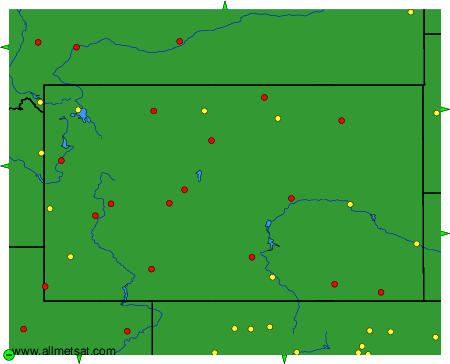
The available stations are represented by yellow and red dots on the map.
Hover mouse over dot to see the name of the station.
Then click to see weather observations and forecasts.
To change the map : click on the green buttons with a black cross to zoom in, on the green button with a dash to zoom out, or on the green arrows for adjacent maps.
