METAR-TAF
Airports :
Salalah International Airport
Salalah, Oman
latitude: 17-02N, longitude: 054-05E, elevation: 20 m
Current weather observation
The report was made 39 minutes ago, at 09:50 UTC
Wind 9 kt from the South/Southwest
Temperature 28°C
Humidity 89%
Pressure 1003 hPa
Visibility: 8000 m
Few clouds at a height of 700 ft
Scattered clouds at a height of 1400 ft
Overcast at a height of 2500 ft
Scattered clouds at a height of 1400 ft
Overcast at a height of 2500 ft
METAR: OOSA 010950Z COR 21009KT 8000 FEW007 SCT014 OVC025 28/26 Q1003 NOSIG
Time: 14:29 (10:29 UTC)
Forecast
The report was made 4 hours and 49 minutes ago, at 05:40 UTC
Forecast valid from 01 at 06 UTC to 02 at 12 UTC
Wind 8 kt from the South
Visibility: 4000 m
Few clouds at a height of 400 ft
Scattered clouds at a height of 900 ft
Overcast at a height of 1600 ft
Scattered clouds at a height of 900 ft
Overcast at a height of 1600 ft
light drizzle
Temporary
from 01 at 09 UTC to 01 at 18 UTC
from 01 at 09 UTC to 01 at 18 UTC
Scattered clouds at a height of 800 ft
Broken clouds at a height of 1400 ft
Overcast at a height of 2000 ft
Broken clouds at a height of 1400 ft
Overcast at a height of 2000 ft
TAF: OOSA 010540Z 0106/0212 19008KT 4000 -DZ FEW004 SCT009 OVC016 TEMPO 0109/0118 NSW SCT008 BKN014 OVC020
Weather observations and forecasts of more than 4000 airports (METAR and TAF reports).
The available stations are represented by yellow and red dots on the map.
Hover mouse over dot to see the name of the station.
Then click to see weather observations and forecasts.
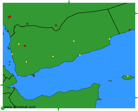
To change the map : click on the green buttons with a black cross to zoom in, on the green button with a dash to zoom out, or on the green arrows for adjacent maps.