METAR-TAF
Airports :
Cambridge Bay
Aklavik
Angoon
Beaver Creek
Burwash
Cambridge Bay
Cape Parry
Cape Peel West
Carmacks
Colville Lake
Croker River
Dawson City
Dease Lake
Deline
Deline
Eagle
Ekati
Faro
Fort Chipewyan
Fort Good Hope
Fort Liard
Fort McMurray
Fort McPherson
Fort Nelson
Fort Providence
Fort Resolution
Fort Simpson
Fort Smith
Fort St. John
Gamèti
Gustavus
Haines
Haines Junction
Hay River
High Level
Hoonah
Ingenika Point
Inuvik
Juneau
Kake
Key Lake
Komakuk Beach
Kugluktuk
Lindberg Landing
Liverpool Bay
Lower Carp Lake
Lupin Mine
Lutselk'e
Mayo
Norman Wells
Northway
Old Crow
Paulatuk
Peace River
Pelly Island
Petersburg
Port Alexander
Sachs Harbour
Shingle Point
Sitka
Skagway
Stony Rapids
Storm Hills
Teslin
Teslin
Trail Valley
Tuktoyaktuk
Tulita
Ulukhaktok
Uranium City
Virginia Falls
Waterton Park Gate
Watson Lake
Wekweeti
Whatì
Whitehorse
Wrangell
Wrigley
Yakutat
Yellowknife
Yukon, Northwest Territories
Alaska
Alaska, British Columbia
Alberta
Arctic Ocean
British Columbia
North America
Nunavut
Saskatchewan
Cambridge Bay Airport Cambridge Bay, Nunavut, Canada
latitude: 69-06N, longitude: 105-07W, elevation: 23 m
Current weather observation The report was made 19 minutes ago, at 18:00 UTC
Wind 3 kt from the East
Temperature -8 °C
Humidity 92 %
Pressure 1005 hPa
Visibility: 24.1 km
Few clouds at a height of 900 ft Few clouds at a height of 7000 ft Broken clouds at a height of 15000 ft Broken clouds at a height of 22000 ft
METAR: CYCB 101800Z 10003KT 15SM FEW009 FEW070 BKN150 BKN220 M08/M09 A2967 RMK SF1AC1AC3CI2 SLP054
Time: 12:19 (18:19 UTC) Forecast The report was made 5 hours and 39 minutes ago, at 12:40 UTC
Forecast valid from 10 at 13 UTC to 11 at 01 UTC
Wind 8 kt from the South/Southeast
Visibility: 10 km
Few clouds at a height of 400 ft Broken clouds at a height of 16000 ft
Probability 30%
Visibility: 1.6 km
Broken clouds at a height of 400 ft Overcast at a height of 16000 ft
mist
From 10 at 1600 UTC
Wind 7 kt from the South/Southeast
Visibility: 10 km
Few clouds at a height of 400 ft Broken clouds at a height of 10000 ft
Temporary
Visibility: 8.0 km
Broken clouds at a height of 400 ft Overcast at a height of 10000 ft
mist
From 10 at 1900 UTC
Wind 7 kt from the South
Visibility: 10 km
Scattered clouds at a height of 1000 ft Broken clouds at a height of 10000 ft
Temporary
Broken clouds at a height of 1000 ft Overcast at a height of 10000 ft
From 10 at 2300 UTC
Wind 6 kt from the Southeast
Visibility: 10 km
Scattered clouds at a height of 1000 ft Overcast at a height of 6000 ft
Temporary
Visibility: 8.0 km
Broken clouds at a height of 1000 ft Overcast at a height of 6000 ft
light snow
TAF: CYCB 101240Z 1013/1101 15008KT P6SM FEW004 BKN160 PROB30 1013/1016 1SM BR BKN004 OVC160 FM101600 16007KT P6SM FEW004 BKN100 TEMPO 1016/1019 5SM BR BKN004 OVC100 FM101900 17007KT P6SM SCT010 BKN100 TEMPO 1019/1023 BKN010 OVC100 FM102300 14006KT P6SM SCT010 OVC060 TEMPO 1023/1101 5SM -SN BKN010 OVC060 RMK NXT FCST BY 101900Z
Weather observations and forecasts of more than 4000 airports (METAR and TAF reports).
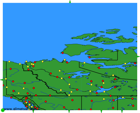
The available stations are represented by yellow and red dots on the map.
Hover mouse over dot to see the name of the station.
Then click to see weather observations and forecasts.
To change the map : click on the green buttons with a black cross to zoom in, on the green button with a dash to zoom out, or on the green arrows for adjacent maps.
