METAR-TAF
Airports :
Saint Paul Island
Adak Island
Anadyr
Asahikawa
Asahikawa Air Base
Atka
Chitose
Gambell
Khabarovsk
Kushiro
Magadan
Memanbetsu
Monbetsu
Nakashibetsu
Obihiro
Petropavlovsk-Kamchatsky
Saint Paul Island
Sapporo
Savoonga
Shemya
St. George
Tokachi-Obihiro
Vladivostok
Wakkanai
Yuzhno-Sakhalinsk
Eastern Siberia
Arctic Ocean
Bering Sea
Central Siberia
China
Japan
Japan, Hokkaido
Japan, Sapporo
North Pacific
St. Paul Island Airport Saint Paul Island, Alaska, United States
latitude: 57-10N, longitude: 170-13W, elevation: 19 m
Current weather observation The report was made 13 minutes ago, at 01:53 UTC
Wind 16 kt from the East
Temperature 6 °C
Humidity 100 %
Pressure 1008 hPa
Visibility: 2.4 km
Overcast at a height of 200 ft
mist
METAR: PASN 010153Z AUTO 09016KT 1 1/2SM BR OVC002 06/06 A2976 RMK AO2 PK WND 08027/0059 RAE24 SLP077 P0001 T00610056 TSNO $
Time: 18:06 (02:06 UTC) Forecast The report was made 2 hours and 35 minutes ago, at 23:31 UTC
Forecast valid from 01 at 00 UTC to 01 at 24 UTC
Wind 18 kt from the East with gusts up to 28 kt
Visibility: 3.2 km
Broken clouds at a height of 300 ft Overcast at a height of 800 ft
light rain, mist
From 01 at 0300 UTC
Wind 16 kt from the East/Southeast
Visibility: 2.4 km
Overcast at a height of 500 ft
mist
From 01 at 0500 UTC
Wind 10 kt from the South/Southwest
Visibility: 2.4 km
Overcast at a height of 300 ft
mist
TAF: PASN 302331Z 0100/0124 08018G28KT 2SM -RA BR BKN003 OVC008 FM010300 12016KT 1 1/2SM BR OVC005 FM010500 20010KT 1 1/2SM BR OVC003
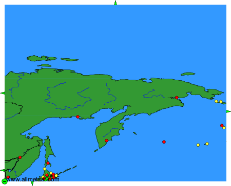
Weather observations and forecasts of more than 4000 airports (METAR and TAF reports).
The available stations are represented by yellow and red dots on the map.
Hover mouse over dot to see the name of the station.
Then click to see weather observations and forecasts.
To change the map : click on the green buttons with a black cross to zoom in, on the green button with a dash to zoom out, or on the green arrows for adjacent maps.