Climate normals
Climate :
Dolores
Argentino Lake
Asunción
Azul
Bahía Blanca
Buenos Aires
Buenos Aires
Ceres
Chamical
Chepes
Comodoro Rivadavia
Concordia
Córdoba
Córdoba
Corrientes
Dolores
Esquel
Ezeiza
Formosa
General Pico
Gualeguaychú
Junín
Laboulaye
La Plata
La Quiaca
La Rioja
Las Lomitas
Malargüe
Maquinchao
Marcos Juárez
Mar del Plata
Mendoza
Mendoza
Monte Caseros
Neuquén
Nueve de Julio
Orán
Paraná
Paso de los Libres
Pehuajó
Pergamino
Pigüé
Pilar Observatorio
Porto Alegre
Posadas
Presidencia Roque Sáenz Peña
Puerto Deseado
Rafaela
Reconquista
Río Cuarto
Rio de Janeiro
Río Gallegos
Rivadavia
Rosario
Salta
San Antonio Oeste
San Carlos de Bariloche
San Luis
San Rafael
Santa Rosa
Santiago del Estero
São Paulo
Trelew
Ushuaia
Verónica
Villa de María del Río Seco
Villa Dolores
Villa Reynolds
Argentina
Antarctica
Bolivia
Brazil
Brazil, São Paulo, Rio de Janeiro
Chile
Paraguay
Peru
South America
South Pacific
Uruguay
Climate : Dolores, Argentina latitude: 36-21S, longitude: 057-44W, elevation: 10 m
Monthly average of the minimum and maximum daily temperatures.°C/°F
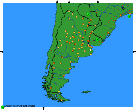
Climatic data of more than 3000 weather stations.
The available stations are represented by yellow and red dots on the map.
Hover mouse over dot to see the name of the station.
Then click to see the data.
To change the map : click on the green buttons with a black cross to zoom in, on the green button with a dash to zoom out, or on the green arrows for adjacent maps.