Climate normals
Climate :
Kahramanmaraş
Abu Kamal
Adana
Afyonkarahisar
Ai-Petri
Aleppo
Alexandroupoli
Al-Hasakah
Al Qamishli
Ankara
Antalya
Armavir
Askania-Nova
Balikesir
Beirut
Bucharest Băneasa
Burgas
Bursa
Çanakkale
Chisinau
Constanţa
Çorum
Damascus
Damascus
Deir Alla
Deir ez-Zor
Diyarbakır
Edirne
Elista
Erzincan
Erzurum
Eskisehir
Feodosiya
Galaţi
Giresun
Gyumri
Hakkâri
Hama
Henichesk
Heraklion
Iasi
Incirlik
Irbid
Isparta
Istanbul
Izmail
İzmir
Kahramanmaraş
Kahramanmaraş
Kars
Kastamonu
Kayseri
Kerch
Kherson
Klepinino
Konya
Krasnodar
Kyrylivka
Larnaca
Latakia
Lemnos
Liubashivka
Malatya
Mersin
Mugla
Mykolaiv
Mytilene-Lesbos
Naxos
Niğde
Nikopol
Odessa
Omu Peak
Palmyra
Primorsko-Akhtarsk
Pyatigorsk
Rhodes
Rize
Rostov-on-Don
Rozdilna
Ruse
Samos
Samsun
Samtredia
Şanlıurfa
Sarata
Siirt
Simferopol
Sivas
Sochi
Sulina
Tartus
Tbilisi
Tel Aviv
Tuapse
Usak
Van
Varna
Volgodonsk
Yalta
Yerevan
Zaporizhia
Zonguldak
Turkey
Armenia
Azerbaijan
Belarus
Bulgaria
Cyprus
Egypt
Europe
Georgia
Greece
Iran
Iraq
Israel
Jordan
Kuwait
Lebanon
Moldova
Palestine
Romania
Russia
Saudi Arabia
Syria
Ukraine
Climate : Kahramanmaraş, Turkey Kahramanmaraş Airport
latitude: 37-32-20N, longitude: 036-57-12E, elevation: 525 m
Monthly average of the minimum and maximum daily temperatures.°C/°F
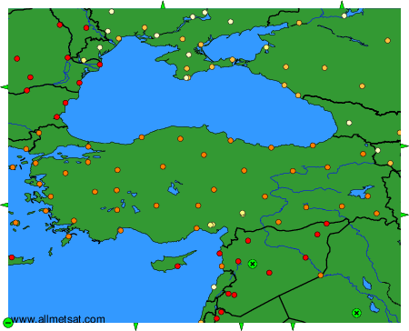
Climatic data of more than 3000 weather stations.
The available stations are represented by yellow and red dots on the map.
Hover mouse over dot to see the name of the station.
Then click to see the data.
To change the map : click on the green buttons with a black cross to zoom in, on the green button with a dash to zoom out, or on the green arrows for adjacent maps.