METAR-TAF
Airports :
Djanet
Adrar
Agadir
Algeciras
Algiers
Al Hoceima
Almería
Annaba
Batna
Béchar
Béjaïa
Beni Mellal
Benslimane
Biskra
Bizerte
Bordj Badji Mokhtar
Bou Saâda
Casablanca
Casablanca-Mohammed V
Ceuta
Chlef
Constantine
Djanet
Djerba
El Bayadh
El Borma
El Goléa
El Oued
Er Rachidia
Essaouira
Faro
Fes
Gabès
Gafsa
Ghadames
Ghardaïa
Ghat
Ghriss
Gibraltar
Granada
Granada
Hammamet
Hassi Messaoud
Hassi R'Mel
Illizi
In Aménas
In Salah
Jendouba
Jerez de la Frontera
Jijel
Kairouan
Kelibia
Laghouat
Lampedusa
Málaga
Marrakech
Mécheria
Meknes
Melilla
Monastir
Morón de la Frontera
Nador
Oran
Ouargla
Ouarzazate
Oujda
Pantelleria
Rabat
Remada
Rhourde Nouss
Rota
Sétif
Seville
Sfax
Tabarka
Tafraoui
Tamanrasset
Tangier
Tébessa
Tétouan
Tiaret
Timimoun
Tindouf
Tin Fouye
Tlemcen
Touggourt
Tozeur
Tripoli
Tunis
Algeria
Africa
Algeria, North
Burkina Faso
France
Italy
Libya
Mali
Mauritania
Morocco
Niger
Portugal
Spain
Tunisia
Djanet Inedbirene Airport Djanet, Algeria
latitude: 24-33N, longitude: 009-28E, elevation: 1054 m
Current weather observation The report was made 43 minutes ago, at 09:00 UTC
Wind 10 kt from the Southeast , varying between East and South
Temperature 36 °C
Humidity 17 %
Pressure 1021 hPa
Visibility 10 km or more
no clouds below 1500 m and no cumulonimbus
METAR: DAAJ 230900Z 13010KT 100V170 CAVOK 36/07 Q1021
Time: 10:43 (09:43 UTC) Forecast The report was made 4 hours and 43 minutes ago, at 05:00 UTC
Forecast valid from 23 at 06 UTC to 24 at 06 UTC
Wind 10 kt from the East/Southeast
Visibility: 7000 m
Probability 30%
Visibility: 4000 m
haze
Becoming
Wind 10 kt from the Southwest
Probability 30% :
Temporary
Few clouds at a height of 4600 ft, Cumulonimbus.
Becoming
Wind 10 kt from the East/Northeast
Probability 30% :
Temporary
Wind 15 kt from the East/Northeast with gusts up to 25 kt
Visibility: 4000 m
Low drifting sand,
TAF: DAAJ 230500Z 2306/2406 12010KT 7000 NSC PROB30 2306/2309 4000 HZ BECMG 2312/2314 23010KT PROB30 TEMPO 2314/2318 FEW046CB BECMG 2318/2320 07010KT PROB30 TEMPO 2320/2402 07015G25KT 4000 DRSA
Weather observations and forecasts of more than 4000 airports (METAR and TAF reports).
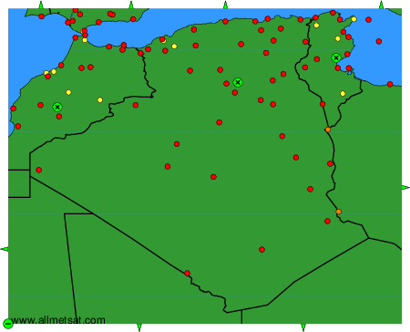
The available stations are represented by yellow and red dots on the map.
Hover mouse over dot to see the name of the station.
Then click to see weather observations and forecasts.
To change the map : click on the green buttons with a black cross to zoom in, on the green button with a dash to zoom out, or on the green arrows for adjacent maps.