METAR-TAF
Airports :
Santa Maria
Antofagasta
Asunción
Bahía Blanca
Buenos Aires-Ezeiza
Buenos Aires-Jorge Newbery
Comodoro Rivadavia
Córdoba
Corrientes
El Palomar
Florianópolis
Formosa
Foz do Iguaçu
Iguaçu
Mar del Plata
Mendoza
Neuquén
Paso de los Libres
Porto Alegre
Posadas
Punta Arenas
Resistencia
Río Cuarto
Río Gallegos
Río Grande
Rosario
Salta
San Carlos de Bariloche
San Fernando
San Juan
San Rafael
San Salvador de Jujuy
Santa Rosa
Santiago
São Paulo
Stanley
Tucumán
Ushuaia
Argentina
Antarctica
Bolivia
Brazil
Brazil, São Paulo, Rio de Janeiro
Chile
Paraguay
Peru
South America
South Pacific
Uruguay
Santa Maria Airport Santa Maria, Rio Grande do Sul, Brazil
latitude: 29-43S, longitude: 053-42W, elevation: 85 m
Current weather observation The report was made 51 minutes ago, at 14:00 UTC
Wind 6 kt from the Southeast , varying between East and South/Southeast
Temperature 21 °C
Humidity 100 %
Pressure 1015 hPa
Visibility: 4000 m
Broken clouds at a height of 600 ft Overcast at a height of 1000 ft
light rain, mist
METAR: SBSM 071400Z 13006KT 090V160 4000 -RA BR BKN006 OVC010 21/21 Q1015
Time: 12:51 (14:51 UTC) Forecast The report was made 5 hours and 51 minutes ago, at 09:00 UTC
Forecast valid from 07 at 12 UTC to 07 at 24 UTC
Wind 8 kt from the Southeast
Visibility 10 km or more
Broken clouds at a height of 1500 ft
Probability 30% from 07 at 12 UTC to 07 at 14 UTC
Visibility: 4000 m
Broken clouds at a height of 2000 ft Few clouds at a height of 3000 ft, Cumulonimbus.
thunderstorm, rain
Becoming from 07 at 14 UTC to 07 at 16 UTC
Broken clouds at a height of 2000 ft
Becoming from 07 at 18 UTC to 07 at 20 UTC
Scattered clouds at a height of 3000 ft
Becoming from 07 at 22 UTC to 07 at 24 UTC
Visibility 10 km or more
no clouds below 1500 m and no cumulonimbus
TAF: SBSM 070900Z 0712/0724 13008KT 9999 BKN015 TN20/0712Z TX27/0719Z PROB30 0712/0714 4000 TSRA BKN020 FEW030CB BECMG 0714/0716 BKN020 BECMG 0718/0720 SCT030 BECMG 0722/0724 CAVOK RMK PEH
Weather observations and forecasts of more than 4000 airports (METAR and TAF reports).
The available stations are represented by yellow and red dots on the map.
Hover mouse over dot to see the name of the station.
Then click to see weather observations and forecasts.
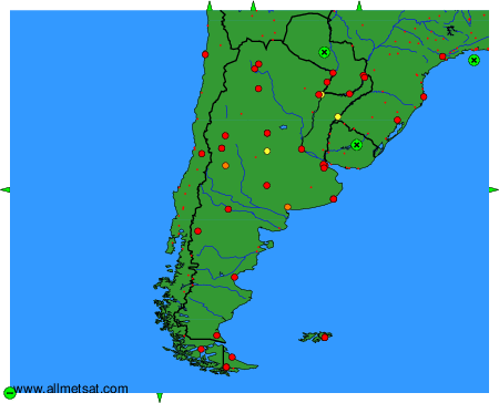
To change the map : click on the green buttons with a black cross to zoom in, on the green button with a dash to zoom out, or on the green arrows for adjacent maps.