METAR-TAF
Airports :
Springfield–Branson National Airport
Springfield, Missouri, United States
latitude: 37-14-23N, longitude: 093-23-23W, elevation: 1266 ft
Current weather observation
The report was made 39 minutes ago, at 16:52 UTC
Wind 13 mph from the North
Temperature 79°F
Humidity 65%
Pressure 29.95 in. Hg
Visibility: 10 miles
Scattered clouds at a height of 3000 ft
Broken clouds at a height of 4100 ft
Broken clouds at a height of 4100 ft
METAR: KSGF 021652Z 01011KT 10SM SCT030 BKN041 26/19 A2995 RMK AO2 SLP130 T02610189 $
Time: 12:31 (17:31 UTC)
Forecast
The report was made 11 minutes ago, at 17:20 UTC
Forecast valid from 02 at 18 UTC to 03 at 18 UTC
Wind 12 mph from the North
Visibility: 6 miles
Few clouds at a height of 2200 ft
Scattered clouds at a height of 3000 ft
Scattered clouds at a height of 3000 ft
From 03 at 0100 UTC
Wind 7 mph from the North/Northeast
Visibility: 6 miles
Few clouds at a height of 23000 ft
TAF: KSGF 021720Z 0218/0318 01010KT P6SM FEW022 SCT030 FM030100 02006KT P6SM FEW230
Weather observations and forecasts of more than 4000 airports (METAR and TAF reports).
The available stations are represented by yellow and red dots on the map.
Hover mouse over dot to see the name of the station.
Then click to see weather observations and forecasts.
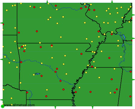
To change the map : click on the green buttons with a black cross to zoom in, on the green button with a dash to zoom out, or on the green arrows for adjacent maps.