METAR-TAF
Airports :
Iquitos
Acarigua
Amapala
Ambato
Apartadó
Arauca
Armenia
Aruba
Barinas
Barquisimeto
Barrancabermeja
Barranquilla
Bluefields
Bocas Town
Bogotá
Bonaire
Bucaramanga
Cali
Caracas
Cartagena
Chinandega
Choluteca
Coro
Cúcuta
Cuenca
Curaçao
David
El Vigia
Esmeraldas
Guanare
Guasdualito
Guayaquil
Ibagué
Ipiales
Iquitos
Jinotega
Juigalpa
La Carlota
La Fría
Latacunga
Leticia
Liberia
Limón
Loja
Macas
Machala
Managua
Manizales
Manta
Maracaibo
Maracay
Medellín
Medellín / Rionegro
Mene Grande
Mérida
Montería
Neiva
Nueva Loja
Panama City
Panama Pacifico
Paraguaná
Pasto
Pereira
Popayán
Providencia Island
Puerto Ayacucho
Puerto Cabello
Puerto Cabezas
Puerto Carreño
Puerto Francisco de Orellana
Quibdó
Quito
Riohacha
Río Hato
Rivas
Salinas
San Andrés
San Antonio del Táchira
San Cristóbal
San Felipe
San Fernando de Apure
San José
San José
San Juan De Los Morros
San Miguel
Santa Bárbara del Zulia
Santa Marta
Santo Domingo
São Gabriel da Cachoeira
Shell Mera
Tabatinga
Talara
Tegucigalpa
Tena
Tocumen
Tulcán
Tumbes
Valencia
Valera
Valledupar
Villavicencio
Colombia
Belize
Brazil
Costa Rica
Cuba
Dominican Republic
Ecuador
El Salvador
Galápagos
Guatemala
Haiti
Honduras
Jamaica
Lesser Antilles
Nicaragua
Panama
Peru
Puerto Rico
South America
Venezuela
Coronel FAP Francisco Secada Vignetta International Airport Iquitos, Peru
latitude: 03-45S, longitude: 073-15W, elevation: 125 m
Current weather observation The report was made 24 minutes ago, at 00:00 UTC
Wind 2 kt from the Southwest
Temperature 26 °C
Humidity 89 %
Pressure 1009 hPa
Visibility 10 km or more
Few clouds at a height of 2000 ft
METAR: SPQT 300000Z 22002KT 9999 FEW020 26/24 Q1009 NOSIG RMK PP000
Time: 19:24 (00:24 UTC) Forecast The report was made 1 hour and 0 minutes ago, at 23:24 UTC
Forecast valid from 30 at 00 UTC to 30 at 24 UTC
Wind 3 kt from variable directions
Visibility 10 km or more
Scattered clouds at a height of 2000 ft Scattered clouds at a height of 10000 ft
Temporary
Few clouds at a height of 2000 ft Few clouds at a height of 2500 ft, Towering cumulus.
Becoming
Broken clouds at a height of 400 ft
Becoming
Broken clouds at a height of 1500 ft Broken clouds at a height of 10000 ft
Temporary
Visibility: 4000 m
Broken clouds at a height of 1500 ft Few clouds at a height of 2500 ft, Towering cumulus. Scattered clouds at a height of 10000 ft
rain showers
TAF: SPQT 292324Z 3000/3024 VRB03KT 9999 SCT020 SCT100 TX30/3018Z TN24/3011Z TEMPO 3000/3001 FEW020 FEW025TCU BECMG 3008/3011 BKN004 BECMG 3013/3015 BKN015 BKN100 TEMPO 3018/3021 4000 SHRA BKN015 FEW025TCU SCT100
Weather observations and forecasts of more than 4000 airports (METAR and TAF reports).
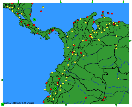
The available stations are represented by yellow and red dots on the map.
Hover mouse over dot to see the name of the station.
Then click to see weather observations and forecasts.
To change the map : click on the green buttons with a black cross to zoom in, on the green button with a dash to zoom out, or on the green arrows for adjacent maps.
