METAR-TAF
Airports :
Spangdahlem
Agen
Ajaccio
Albenga
Albert
Alderney
Alpnach
Amsterdam
Andora
Angers
Angoulême
Annecy
Antwerp
Arnhem
Aurillac
Avignon
Avord
Baden-Baden
Barcelona
Barkston Heath
Basel-Mulhouse
Bastia
Beauvais
Beauvechain
Benson
Bergamo
Bergerac
Berne
Béziers
Biarritz
Bilbao
Birmingham
Bordeaux
Boscombe Down
Bournemouth
Brest
Brighton
Bristol
Brive-la-Gaillarde
Brize Norton
Brussels
Büchel
Bückeburg
Buochs
Burgos
Bütgenbach
Caen
Calais
Calvi
Cambridge
Cannes
Carcassonne
Cardiff
Castres
Cazaux
Châlons-en-Champagne
Chambery / Aix-Les-Bains
Charleroi
Châteaudun
Châteauroux
Cherbourg
Chièvres
Clermont-Ferrand
Cognac
Colmar
Cologne
Cranfield
Cuneo
Dax
Deauville
Den Helder
Diepholz
Diest
Dijon
Dinard
Dole
Dornbirn
Dortmund
Dübendorf
Düsseldorf
East Midlands
Egelsbach
Eindhoven
Emmen
Épinal
Euro
Évreux
Exeter
Fairford
Farnborough
Figari
Florennes
Frankfurt
Friedrichshafen
Fritzlar
Geilenkirchen
Geneva
Genoa
Gilze-Rijen
Girona
Gloucester
Goeree Le
Grenchen
Grenoble
Guernsey
Hahn
Hanover
Holbeach
Hoorn-a
Huesca
Istres
Jersey
Kassel
Koksijde
La Chaux-de-Fonds
Lahr
Lakenheath
Landivisiau
Lannion
Lanvéoc
La Rochelle
La Roche-sur-Yon
La Seu d'Urgell
Laupheim
Laval
Le Havre
Le Luc
Lelystad
Le Mans
Le Touquet
Liège
Lille
Limoges
Lleida
Locarno
Logroño
London Biggin Hill
London-City
London-Gatwick
London-Heathrow
London-Luton
London-Southend
London-Stansted
Lorient
Lugano
Luxembourg
Luxeuil-les-Bains
Lydd
Lyon
Lyon / Saint Exupéry
Maastricht Aachen
Mannheim
Marham
Marseille
Meiringen
Melun
Meppen
Metz-Nancy-Lorraine
Middle Wallop
Milan-Linate
Milan-Malpensa
Mildenhall
Mönchengladbach
Mont-De-Marsan
Montpellier
Morlaix
Münster-Osnabrück
Nancy-Essey
Nancy-Ochey
Nantes
Nevers
Newquay Cornwall
Nice
Niederstetten
Nîmes
Northolt
Nörvenich
Norwich
Novara
Odiham
Orange
Orléans
Ostend
Oxford
P11-b
Paderborn-Lippstadt
Pamplona
Paris-Charles De Gaulle
Paris–Le Bourget
Paris-Orly
Passo dei Giovi
Passo della Cisa
Pau
Payerne
Peer
Pembrey
Perpignan
Piacenza
Pian Rosa
Poitiers
Pontoise
Prato Nevoso
Quimper
Ramstein
Reims
Rennes
Reus
Rheine
Rodez
Romorantin
Rotterdam
Rouen
Saarbrücken
Sabadell
Saint-Brieuc
Saint-Dizier
Saint-Etienne
Saint-Nazaire
Saint-Yan
Salon-de-Provence
San Sebastián
Santander
Sarzana
Schwäbisch Hall
Shawbury
Siegen
Sion
Solenzara
Southampton
Spangdahlem
St Athan
St. Gallen
St. Moritz
Strasbourg
Stuttgart
Tarbes Lourdes
Toulon
Toulouse
Tours
Toussus-le-Noble
Troyes
Turin-Aeritalia
Turin-Bric della Croce
Turin-Caselle
Uden
Valence
Valladolid
Vannes
Villacoublay
Vitoria
Vlissingen
Wattisham
Weeze
Wiesbaden
Wittering
Woensdrecht
Wunstorf
Yeovilton
Zaragoza
Zürich
France
Austria
Belgium
Czech Republic
England
Europe
Germany
Ireland
Italy
Italy, North
Luxembourg
Netherlands
Portugal
Slovenia
Spain
Switzerland
United Kingdom
Wales
Spangdahlem Air Base Spangdahlem, Germany
latitude: 49-59N, longitude: 006-42E, elevation: 365 m
Current weather observation The report was made 19 minutes ago, at 23:55 UTC
Wind 7 kt from the North/Northeast
Temperature 4 °C
Humidity 87 %
Pressure 994 hPa
Visibility 10 km or more
Broken clouds at a height of 700 ft Broken clouds at a height of 3300 ft Overcast at a height of 13000 ft
METAR: ETAD 132355Z AUTO 02007KT 9999 BKN007 BKN033 OVC130 04/02 A2936 RMK AO2 CIG 007V033 BKN007 V SCT SLP939 60000 T00370024 10066 20037 52014 FZRANO $
Time: 01:14 (00:14 UTC) Forecast The report was made 3 hours and 14 minutes ago, at 21:00 UTC
Forecast valid from 13 at 21 UTC to 15 at 03 UTC
Wind 6 kt from the Northeast
Visibility 10 km or more
Broken clouds at a height of 2500 ft Broken clouds at a height of 18000 ft
Becoming
Wind 10 kt from the East/Northeast with gusts up to 15 kt
Visibility 10 km or more
Scattered clouds at a height of 600 ft Scattered clouds at a height of 800 ft Broken clouds at a height of 1000 ft
Temporary
Wind 10 kt from the East/Northeast with gusts up to 20 kt
Broken clouds at a height of 600 ft Overcast at a height of 800 ft
Becoming
Wind 10 kt from the Northeast with gusts up to 20 kt
Visibility 10 km or more
Broken clouds at a height of 1000 ft
Becoming
Wind 6 kt from the Northeast
Visibility 10 km or more
Broken clouds at a height of 1500 ft
Becoming
Wind 3 kt from the West
Visibility 10 km or more
Scattered clouds at a height of 1500 ft
TAF: ETAD 132100Z 1321/1503 04006KT 9999 BKN025 BKN180 QNH2932INS BECMG 1400/1401 06010G15KT 9999 SCT006 SCT008 BKN010 QNH2937INS TEMPO 1401/1411 06010G20KT BKN006 OVC008 BECMG 1410/1411 04010G20KT 9999 BKN010 QNH2965INS BECMG 1416/1417 04006KT 9999 BKN015 QNH2987INS BECMG 1500/1501 28003KT 9999 SCT015 QNH3002INS TX05/1321Z TNM02/1421Z
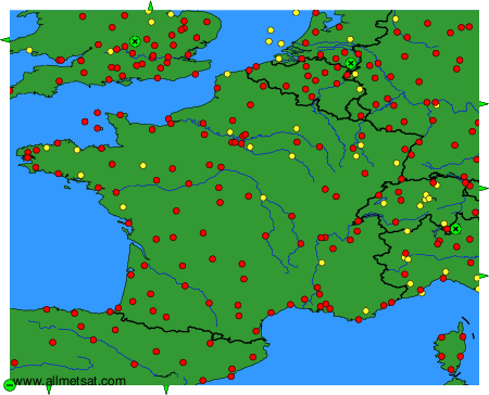
Weather observations and forecasts of more than 4000 airports (METAR and TAF reports).
The available stations are represented by yellow and red dots on the map.
Hover mouse over dot to see the name of the station.
Then click to see weather observations and forecasts.
To change the map : click on the green buttons with a black cross to zoom in, on the green button with a dash to zoom out, or on the green arrows for adjacent maps.
