METAR-TAF
Airports :
Ramstein
Aigen im Ennstal
Altenburg
Altenstadt
Ansbach
Arnhem
Augsburg
Awg-1
Baden-Baden
Basel-Mulhouse
Berlin
Braunschweig
Bremen
Büchel
Bückeburg
Bütgenbach
Čáslav
Celle
Colmar
Cologne
Diepholz
Dornbirn
Dortmund
Dresden
Dübendorf
Düsseldorf
Egelsbach
Emmen
Épinal
Erfurt
Faßberg
Finkenwerder
Frankfurt
Friedrichshafen
Fritzlar
Geilenkirchen
Glücksburg
Grafenwöhr
Graz
Grenchen
Groningen
Hahn
Hamburg
Hanover
Heringsdorf
Hof
Hohenfels
Hohn
Holzdorf
Illesheim
Ingolstadt
Innsbruck
Karlovy Vary
Kassel
Kiel
La Chaux-de-Fonds
Lahr
Laupheim
Lechfeld
Leeuwarden
Leipzig
Lelystad
Linz
Lübeck
Luxembourg
Luxeuil-les-Bains
Maastricht Aachen
Magdeburg
Mannheim
Mecklenburg
Memmingen
Meppen
Metz-Nancy-Lorraine
Mönchengladbach
Munich
Münster-Osnabrück
Nancy-Essey
Nancy-Ochey
Neuburg
Niederstetten
Nordholz
Nörvenich
Nuremberg
Oberpfaffenhofen
Paderborn-Lippstadt
Plzeň
Prague
Prague
Prague
Ramstein
Rheine
Rostock
Saarbrücken
Salzburg
Schleswig-Jagel
Schwäbisch Hall
Siegen
Sønderborg
Spangdahlem
St. Gallen
Strasbourg
Stuttgart
Szczecin
Uden
Weeze
Westerland
Wiesbaden
Wittmund
Wunstorf
Zell am See
Zeltweg
Zürich
Germany
Austria
Belgium
Czech Republic
Denmark
Europe
France
Italy
Italy, North
Luxembourg
Netherlands
Poland
Scandinavia, Southwest
Slovenia
Switzerland
United Kingdom
Ramstein Air Base Ramstein, Germany
latitude: 49-26N, longitude: 007-36E, elevation: 238 m
Current weather observation The report was made 36 minutes ago, at 20:55 UTC
Wind 6 kt from the Southwest
Temperature 16 °C
Humidity 59 %
Pressure 1016 hPa
Visibility 10 km or more
Few clouds at a height of 8000 ft
METAR: ETAR 152055Z AUTO 22006KT 9999 FEW080 16/08 A3000 RMK AO2 SLP161 T01630083 52021 TSNO
Time: 23:31 (21:31 UTC) Forecast The report was made 3 hours and 31 minutes ago, at 18:00 UTC
Forecast valid from 15 at 18 UTC to 16 at 24 UTC
Wind 10 kt from the West/Southwest with gusts up to 20 kt
Visibility 10 km or more
Scattered clouds at a height of 4000 ft
Temporary from 15 at 18 UTC to 15 at 22 UTC
Wind 15 kt from the West/Northwest with gusts up to 30 kt
Becoming from 15 at 22 UTC to 15 at 24 UTC
Wind 10 kt from the West with gusts up to 25 kt
Visibility 10 km or more
Broken clouds at a height of 6000 ft Overcast at a height of 8000 ft
Temporary from 16 at 00 UTC to 16 at 04 UTC
Wind 15 kt from the West/Northwest with gusts up to 30 kt
Becoming from 16 at 04 UTC to 16 at 06 UTC
Wind 10 kt from the West with gusts up to 20 kt
Visibility 10 km or more
Broken clouds at a height of 3000 ft
Becoming from 16 at 12 UTC to 16 at 14 UTC
Wind 10 kt from the West with gusts up to 15 kt
Visibility 10 km or more
Scattered clouds at a height of 5000 ft
Becoming from 16 at 18 UTC to 16 at 20 UTC
Wind 10 kt from the West/Southwest with gusts up to 25 kt
Visibility 10 km or more
Broken clouds at a height of 3500 ft
TAF: ETAR 151800Z 1518/1624 24010G20KT 9999 SCT040 QNH2997INS TEMPO 1518/1522 30015G30KT 510003 BECMG 1522/1524 28010G25KT 9999 BKN060 OVC080 QNH2999INS TEMPO 1600/1604 30015G30KT 510003 BECMG 1604/1606 28010G20KT 9999 BKN030 QNH2993INS BECMG 1612/1614 26010G15KT 9999 SCT050 QNH3012INS BECMG 1618/1620 24010G25KT 9999 BKN035 QNH3014INS TX22/1523Z TN13/1604Z
Weather observations and forecasts of more than 4000 airports (METAR and TAF reports).
The available stations are represented by yellow and red dots on the map.
Hover mouse over dot to see the name of the station.
Then click to see weather observations and forecasts.
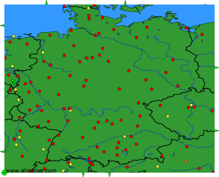
To change the map : click on the green buttons with a black cross to zoom in, on the green button with a dash to zoom out, or on the green arrows for adjacent maps.