METAR-TAF
Airports :
Izmir
Alexandroupoli
Andravida
Araxos
Athens
Aydın
Balikesir
Bandirma
Bodrum
Çanakkale
Chania
Chios
Corfu
Çorlu
Dalaman
Edremit
Eleusina
Gökçeada
Heraklion
Ioannina
Istanbul
Istanbul Atatürk
Izmir
Izmir
Kalamata
Karpathos
Kavala
Kefalonia
Kos
Kozani
Kythira
Larissa
Lemnos
Mykonos
Mytilene-Lesbos
Naxos
Ohrid
Paros
Preveza
Rhodes
Samos
Santorini
Skiathos
Skopje
Skyros
Syros
Tanagra
Thessaloniki
Tirana
Volos
Zakynthos
Greece
Albania
Bosnia and Herzegovina
Bulgaria
Croatia
Europe
Italy
Libya
Macedonia
Montenegro
Romania
Serbia
Slovenia
Turkey
Adnan Menderes Airport Izmir, Turkey
latitude: 38-16N, longitude: 027-09E, elevation: 125 m
Current weather observation The report was made 31 minutes ago, at 12:20 UTC
Wind 8 kt from the Southwest , varying between South and West
Temperature 21 °C
Humidity 69 %
Pressure 1015 hPa
Visibility 10 km or more
Scattered clouds at a height of 3000 ft Broken clouds at a height of 20000 ft
METAR: LTBJ 231220Z 23008KT 180V260 9999 SCT030 BKN200 21/15 Q1015 RESHRA NOSIG RMK RWY16 24011KT
Time: 15:51 (12:51 UTC) Forecast The report was made 2 hours and 11 minutes ago, at 10:40 UTC
Forecast valid from 23 at 12 UTC to 24 at 12 UTC
Wind 2 kt from variable directions
Visibility 10 km or more
Scattered clouds at a height of 3000 ft Broken clouds at a height of 20000 ft
Temporary from 23 at 12 UTC to 23 at 15 UTC
Wind 12 kt from the South/Southwest
Broken clouds at a height of 3000 ft
light rain showers
Temporary from 23 at 17 UTC to 23 at 21 UTC
Broken clouds at a height of 3000 ft
light rain showers
Becoming from 23 at 21 UTC to 23 at 24 UTC
Visibility 10 km or more
no clouds below 1500 m and no cumulonimbus
Probability 30% from 24 at 04 UTC to 24 at 07 UTC
Visibility: 4000 m
mist
Becoming from 24 at 05 UTC to 24 at 07 UTC
Few clouds at a height of 2700 ft
TAF: LTBJ 231040Z 2312/2412 VRB02KT 9999 SCT030 BKN200 TEMPO 2312/2315 21012KT -SHRA BKN030 TEMPO 2317/2321 -SHRA BKN030 BECMG 2321/2324 CAVOK PROB30 2404/2407 4000 BR BECMG 2405/2407 FEW027
Weather observations and forecasts of more than 4000 airports (METAR and TAF reports).
The available stations are represented by yellow and red dots on the map.
Hover mouse over dot to see the name of the station.
Then click to see weather observations and forecasts.
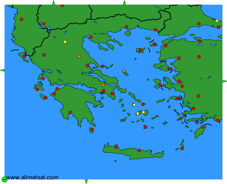
To change the map : click on the green buttons with a black cross to zoom in, on the green button with a dash to zoom out, or on the green arrows for adjacent maps.