METAR-TAF
Airports :
Puerto Barrios Airport
Puerto Barrios, Guatemala
latitude: 15-43N, longitude: 088-36W, elevation: 1 m
Current weather observation
Broken clouds at a height of 9000 ft
METAR: MGPB 260700Z 00000KT 9999 SCT016 BKN090 25/25 Q1012 A2988
Time: 01:23 (07:23 UTC)
Forecast
Few clouds at a height of 2500 ft, Cumulonimbus.
from 25 at 20 UTC to 25 at 22 UTC
from 25 at 20 UTC to 25 at 24 UTC
from 26 at 01 UTC to 26 at 03 UTC
Scattered clouds at a height of 9000 ft
from 26 at 02 UTC to 26 at 08 UTC
Broken clouds at a height of 8000 ft
from 26 at 09 UTC to 26 at 12 UTC
Overcast at a height of 8000 ft
from 26 at 18 UTC to 26 at 20 UTC
Broken clouds at a height of 9000 ft
TAF: MGPB 251700Z 2518/2618 35008KT 9999 SCT018 FEW025CB TX32/2520Z TN22/2512Z BECMG 2520/2522 SCT020 TEMPO 2520/2524 8000 TSRA FEW025CB BECMG 2601/2603 00000KT SCT016 SCT090 TEMPO 2602/2608 7000 RA BKN016 BKN080 TEMPO 2609/2612 DZ BKN016 OVC080 BECMG 2618/2620 SCT018 BKN090
Weather observations and forecasts of more than 4000 airports (METAR and TAF reports).
The available stations are represented by yellow and red dots on the map.
Hover mouse over dot to see the name of the station.
Then click to see weather observations and forecasts.
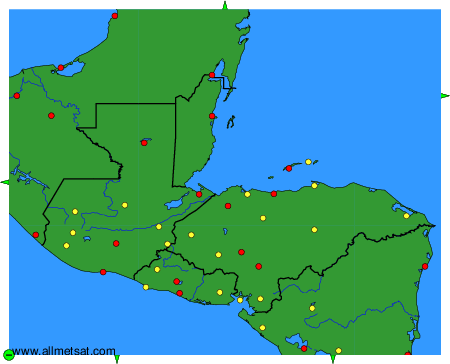
To change the map : click on the green buttons with a black cross to zoom in, on the green button with a dash to zoom out, or on the green arrows for adjacent maps.