METAR-TAF
Airports :
Banja Luka
Arad
Bad Vöslau
Baia Mare
Banja Luka
Batajnica
Békéscsaba
Belgrade
Bratislava
Brno
Budapest
Câmpia Turzii
Čáslav
Cerklje ob Krki
Cluj-Napoca
Craiova
Debrecen
Graz
Győr
Hévíz
Katowice
Kecskemét
Košice
Kraków
Łódź
Lublin
Lviv
Maribor
Náměšť nad Oslavou
Oradea
Osijek
Ostrava
Pápa
Pardubice
Pécs
Piešťany
Poprad
Prague
Radom
Rijeka
Rzeszów
Satu Mare
Sibiu
Sliač
Szeged
Szolnok
Timişoara
Tomaszów Mazowiecki
Tulln an der Donau
Tuzla
Uherské Hradiště
Uzhhorod
Vienna
Vršac
Wiener Neustadt
Wrocław
Zadar
Zagreb
Zeltweg
Žilina
Hungary, Slovakia
Albania
Austria
Belarus
Bosnia and Herzegovina
Bulgaria
Croatia
Czech Republic
Europe
Germany
Italy
Macedonia
Moldova
Montenegro
Poland
Romania
Serbia
Slovenia
Ukraine
Banja Luka International Airport Banja Luka, Bosnia and Herzegovina
latitude: 44-47N, longitude: 017-13E, elevation: 156 m
Current weather observation The report was made 34 minutes ago, at 10:00 UTC
Wind 2 kt from variable directions
Temperature 9 °C
Humidity 71 %
Pressure 1027 hPa
Visibility 10 km or more
no clouds below 1500 m and no cumulonimbus
METAR: LQBK 221000Z VRB02KT CAVOK 09/04 Q1027 NOSIG
Time: 11:34 (10:34 UTC) Forecast The report was made 5 hours and 34 minutes ago, at 05:00 UTC
Forecast valid from 22 at 06 UTC to 23 at 06 UTC
Wind 5 kt from the Southwest
Visibility 10 km or more
no clouds below 1500 m and no cumulonimbus
Probability 40% :
Temporary
Visibility: 4000 m
mist
Probability 30%
Visibility: 1500 m
patches of fog
Temporary
Visibility: 3000 m
mist
Probability 40%
Visibility: 0400 m
at a height of 200 ft
fog
TAF: LQBK 220500Z 2206/2306 22005KT CAVOK TX12/2213Z TNM02/2206Z PROB40 TEMPO 2206/2209 4000 BR PROB30 2206/2208 1500 BCFG TEMPO 2222/2306 3000 BR PROB40 2300/2306 0400 FG VV002
Weather observations and forecasts of more than 4000 airports (METAR and TAF reports).
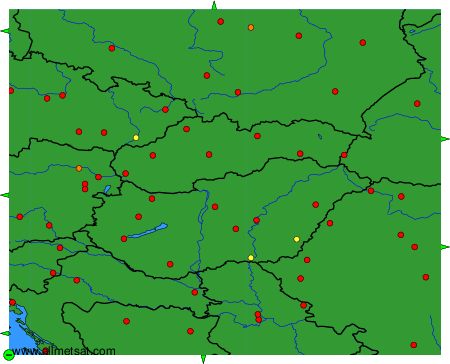
The available stations are represented by yellow and red dots on the map.
Hover mouse over dot to see the name of the station.
Then click to see weather observations and forecasts.
To change the map : click on the green buttons with a black cross to zoom in, on the green button with a dash to zoom out, or on the green arrows for adjacent maps.
