METAR-TAF
Airports :
Vestmannaeyjar Airport
Vestmannaeyjar, Iceland
latitude: 63-24N, longitude: 020-17W, elevation: 118 m
Current weather observation
The report was made 7 hours and 26 minutes ago, at 19:00 UTC
Wind 10 kt from the South/Southeast with gusts up to 24 kt, varying between East and South/Southwest
Temperature 10°C
Humidity 100%
Pressure 1000 hPa
Visibility 10 km or more
Overcast at a height of 300 ft
light rain
METAR: BIVM 081900Z 16010G24KT 080V200 9999 -RA OVC003 10/10 Q1000
Time: 02:26 (02:26 UTC)
Forecast
The report was made 10 hours and 15 minutes ago, at 16:11 UTC
Forecast valid from 08 at 17 UTC to 08 at 20 UTC
Wind 10 kt from the South/Southeast
Visibility 10 km or more
Scattered clouds at a height of 800 ft
Broken clouds at a height of 1200 ft
Overcast at a height of 2500 ft
Broken clouds at a height of 1200 ft
Overcast at a height of 2500 ft
light drizzle
Becoming
from 08 at 18 UTC to 08 at 20 UTC
from 08 at 18 UTC to 08 at 20 UTC
Visibility: 3500 m
Overcast at a height of 800 ft
rain, drizzle, mist
TAF: BIVM 081611Z 0817/0820 16010KT 9999 -DZ SCT008 BKN012 OVC025 BECMG 0818/0820 3500 RADZ BR OVC008
Weather observations and forecasts of more than 4000 airports (METAR and TAF reports).
The available stations are represented by yellow and red dots on the map.
Hover mouse over dot to see the name of the station.
Then click to see weather observations and forecasts.
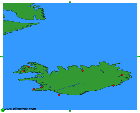
To change the map : click on the green buttons with a black cross to zoom in, on the green button with a dash to zoom out, or on the green arrows for adjacent maps.