METAR-TAF
Airports :
Rabat–Salé Airport
Rabat, Morocco
latitude: 34-03N, longitude: 006-46W, elevation: 84 m
Current weather observation
The report was made 16 minutes ago, at 20:00 UTC
Wind 4 kt from the North, varying between Northwest and North/Northeast
Temperature 22°C
Humidity 88%
Pressure 1017 hPa
Visibility: 7000 m
Scattered clouds at a height of 1600 ft
Scattered clouds at a height of 16600 ft
Scattered clouds at a height of 16600 ft
METAR: GMME 262000Z 35004KT 310V020 7000 SCT016 SCT166 22/20 Q1017 NOSIG
Time: 21:16 (20:16 UTC)
Forecast
The report was made 9 hours and 16 minutes ago, at 11:00 UTC
Forecast valid from 26 at 12 UTC to 27 at 18 UTC
Wind 10 kt from the North
Visibility: 7000 m
Temporary
from 26 at 12 UTC to 26 at 20 UTC
from 26 at 12 UTC to 26 at 20 UTC
Wind 12 kt from the West/Northwest with gusts up to 23 kt
Scattered clouds at a height of 1600 ft
TAF: GMME 261100Z 2612/2718 36010KT 7000 NSC TEMPO 2612/2620 30012G23KT SCT016
Weather observations and forecasts of more than 4000 airports (METAR and TAF reports).
The available stations are represented by yellow and red dots on the map.
Hover mouse over dot to see the name of the station.
Then click to see weather observations and forecasts.
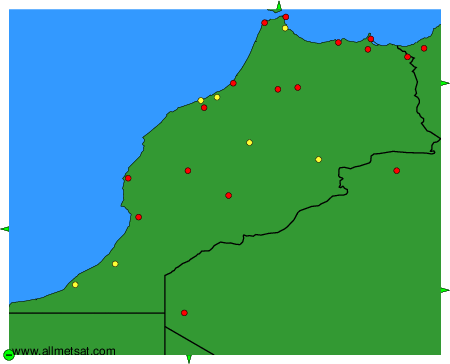
To change the map : click on the green buttons with a black cross to zoom in, on the green button with a dash to zoom out, or on the green arrows for adjacent maps.