METAR-TAF
Airports :
Taloyoak
Akulivik
Alert
Arctic Bay
Arviat
Aupaluk
Brevoort Island
Cape Dorset
Cape Dyer
Cape Hooper
Cape Kakkiviak
Cape Kiglapait
Cape Mercy
Chesterfield Inlet
Churchill
Clyde
Coral Harbour
Dewar Lakes
Eureka
Fort Severn
Grise Fiord
Hall Beach
Igloolik
Inukjuak
Iqaluit
Ivujivik
Kangiqsualujjuaq
Kangiqsujuaq
Kangirsuk
Kimmirut
Kugaaruk
Kugaaruk
Kuujjuaq
Longstaff Bluff
Nain
Pangnirtung
Pond Inlet
Puvirnituq
Qikiqtarjuaq
Qikiqtarjuaq
Quaqtaq
Rankin Inlet
Repulse Bay
Resolution Island
Saglek Bay
Salluit
Sanikiluaq
Shepherd Bay
Taloyoak
Tasiujaq
Thule
Umiujaq
Whale Cove
Nunavut, Baffin Island, Ellesmere
Arctic Ocean
Greenland
Manitoba
North America
Nunavut
Ontario, North
Quebec
Taloyoak Airport Taloyoak, Nunavut, Canada
latitude: 69-33N, longitude: 093-35W, elevation: 28 m
Current weather observation The report was made 6 hours and 17 minutes ago, at 02:30 UTC
Wind 4 kt from the Southeast
Temperature 7 °C
Humidity 81 %
Pressure 1021 hPa
Visibility: 24.1 km
Few clouds at a height of 17000 ft Few clouds at a height of 25000 ft
METAR: CYYH 220230Z 14004KT 15SM FEW170 FEW250 07/04 A3015 RMK AC1CI1 AC TR CI TR LAST STFD OBS/NXT 221430Z SLP215
Time: 02:47 (08:47 UTC) Forecast The report was made 9 hours and 7 minutes ago, at 23:40 UTC
Forecast valid from 22 at 00 UTC to 22 at 12 UTC
Wind 12 kt from the West
Visibility: 10 km
Few clouds at a height of 18000 ft Few clouds at a height of 24000 ft
Becoming
Wind 7 kt from the South
From 22 at 0700 UTC
Wind 7 kt from the South
Visibility: 10 km
Scattered clouds at a height of 25000 ft
From 22 at 1100 UTC
Wind 8 kt from the South
Visibility: 10 km
Broken clouds at a height of 20000 ft
TAF: CYYH 212340Z 2200/2212 27012KT P6SM FEW180 FEW240 BECMG 2205/2207 19007KT FM220700 19007KT P6SM SCT250 FM221100 18008KT P6SM BKN200 RMK NXT FCST BY 220600Z
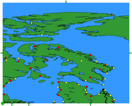
Weather observations and forecasts of more than 4000 airports (METAR and TAF reports).
The available stations are represented by yellow and red dots on the map.
Hover mouse over dot to see the name of the station.
Then click to see weather observations and forecasts.
To change the map : click on the green buttons with a black cross to zoom in, on the green button with a dash to zoom out, or on the green arrows for adjacent maps.