METAR-TAF
Airports :
Punta Arenas
Abidjan
Accra
Antofagasta
Asunción
Bamako
Bangui
Belém
Bogotá
Brasília
Cape Town
Caracas
Cayenne
Conakry
Córdoba
Curaçao
Dakar
Florianópolis
Fort-de-France
Foz do Iguaçu
Georgetown
Kinshasa
Lagos
La Paz
Libreville
Luanda
Malabo
Mar del Plata
Mendoza
Natal
N'Djamena
Niamey
Ouagadougou
Pointe-Noire
Porto Alegre
Port of Spain
Punta Arenas
Recife
Santiago
São Paulo
Stanley
Ushuaia
Yaoundé
South Atlantic
Africa
Angola
Antarctica
Argentina
Benin
Bolivia
Botswana
Brazil
Brazil, São Paulo, Rio de Janeiro
Cameroon
Chile
Congo
Equatorial Guinea
Gabon
Gambia
Ghana
Guinea
Guinea-Bissau
Guyana, Suriname, French Guiana
Indian Ocean
Ivory coast
Liberia
Namibia
Nigeria
North America
North Atlantic
Paraguay
São Tomé and Príncipe
Senegal
Sierra Leone
South Africa
South America
South Pacific
Togo
Trinidad and Tobago
Uruguay
Venezuela
Presidente Carlos Ibáñez del Campo International Airport Punta Arenas, Chile
latitude: 53-00S, longitude: 070-51W, elevation: 37 m
Current weather observation The report was made 23 minutes ago, at 20:00 UTC
Wind 2 kt from the Southeast
Temperature 6 °C
Humidity 93 %
Pressure 993 hPa
Visibility: 3700 m
Few clouds at a height of 500 ft Scattered clouds at a height of 1600 ft Overcast at a height of 3400 ft
light drizzle
METAR: SCCI 042000Z 14002KT 3700 -DZ FEW005 SCT016 OVC034 06/05 Q0993 NOSIG
Time: 16:23 (20:23 UTC) Forecast The report was made 4 hours and 22 minutes ago, at 16:01 UTC
Forecast valid from 04 at 18 UTC to 05 at 18 UTC
Wind 4 kt from the East
Visibility: 5000 m
Broken clouds at a height of 600 ft Overcast at a height of 1500 ft
mist, light rain
Temporary
Wind 4 kt from the West
Visibility: 3000 m
Overcast at a height of 400 ft
rain, mist
Becoming
Wind 12 kt from the East
Becoming
Wind 8 kt from the West
Visibility: 8000 m
Scattered clouds at a height of 1400 ft Broken clouds at a height of 2000 ft
light rain showers
TAF: SCCI 041601Z 0418/0518 08004KT 5000 BR -RA BKN006 OVC015 TN03/0510Z TX06/0518Z TEMPO 0418/0503 26004KT 3000 RA BR OVC004 BECMG 0500/0502 09012KT BECMG 0515/0517 27008KT 8000 -SHRA SCT014 BKN020
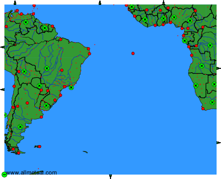
Weather observations and forecasts of more than 4000 airports (METAR and TAF reports).
The available stations are represented by yellow and red dots on the map.
Hover mouse over dot to see the name of the station.
Then click to see weather observations and forecasts.
To change the map : click on the green buttons with a black cross to zoom in, on the green button with a dash to zoom out, or on the green arrows for adjacent maps.
