METAR-TAF
Airports :
San Antonio
Alice
Angleton / Lake Jackson
Austin–Bergstrom
Austin-Camp Mabry
Austin-Executive
Bay City
Beaumont
Beaumont / Port Arthur
Brenham
Brownsville
Brownwood
Bryan
Burnet
Coleman
College Station
Comanche
Corpus Christi
Corpus Christi / Kingsville
Cotulla
Del Rio
Del Rio
DeRidder
Edinburg
Falfurrias
Fort Hood / Killeen
Fort Hood / Killeen
Fredericksburg
Galveston
Gatesville
Georgetown
Giddings
Hamilton
Harlingen
Hearne
Hebbronville
Hondo
Houston
Houston
Houston
Houston
Houston
Houston / Conroe
Houston / Pearland
Houston / Sugar Land
Houston / Tomball
Huntsville
Jacksonville
Jasper
Junction
Kerrville
Killeen
Kingsville
La Grange
Lake Charles
Lake Charles
Laredo
Llano
Lufkin
Matamoros
McAllen
Monterrey
Monterrey Del Norte
Nacogdoches
Natchitoches
New Braunfels
Nuevo Laredo
Orange
Palacios
Palestine
Piedras Negras
Port Isabel
Port Lavaca
Reynosa
Robstown
Rockport
Rocksprings
San Angelo
San Antonio
San Antonio
San Antonio
San Marcos
Sonora
Temple
Universal City
Uvalde
Victoria
Waco
Waco
Waco
Weslaco
Wharton
Texas, South
Louisiana
Mexico, Northeast
North America
Texas, East
Texas, West
Kelly Field Annex San Antonio, Texas, United States
latitude: 29-23N, longitude: 098-35W, elevation: 689 ft
Current weather observation The report was made 30 minutes ago, at 17:55 UTC
Wind 13 mph from the North
Temperature 75 °F
Humidity 20 %
Pressure 30.05 in. Hg
Visibility: 10 miles
Overcast at a height of 7000 ft
METAR: KSKF 211755Z AUTO 01011KT 10SM OVC070 24/M00 A3005 RMK AO2 SLP171 T02351001 10246 20166 52023 $
Time: 12:25 (18:25 UTC) Forecast The report was made 25 minutes ago, at 18:00 UTC
Forecast valid from 21 at 18 UTC to 22 at 24 UTC
Wind 20 mph from the North with gusts up to 30 mph
Visibility 6.2 miles or more
Broken clouds at a height of 7000 ft
Becoming
Wind 18 mph from the North with gusts up to 29 mph
Visibility 6.2 miles or more
Clear sky
Becoming
Wind 14 mph from the North
Visibility 6.2 miles or more
Clear sky
Becoming
Wind 16 mph from the North/Northeast with gusts up to 25 mph
Visibility 6.2 miles or more
Few clouds at a height of 25000 ft
Becoming
Wind 14 mph from the Northeast with gusts up to 21 mph
Visibility 6.2 miles or more
Few clouds at a height of 25000 ft
Becoming
Wind 10 mph from the Northeast
Visibility 6.2 miles or more
Few clouds at a height of 25000 ft
TAF: KSKF 211800Z 2118/2224 36017G26KT 9999 BKN070 510005 QNH3000INS BECMG 2201/2202 01016G25KT 9999 SKC 510006 QNH3022INS BECMG 2209/2210 01012KT 9999 SKC 510046 QNH3045INS BECMG 2214/2215 02014G22KT 9999 FEW250 510005 QNH3056INS BECMG 2217/2218 04012G18KT 9999 FEW250 QNH3049INS BECMG 2220/2221 05009KT 9999 FEW250 QNH3046INS TX25/2122Z TN06/2213Z
Weather observations and forecasts of more than 4000 airports (METAR and TAF reports).
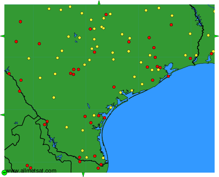
The available stations are represented by yellow and red dots on the map.
Hover mouse over dot to see the name of the station.
Then click to see weather observations and forecasts.
To change the map : click on the green buttons with a black cross to zoom in, on the green button with a dash to zoom out, or on the green arrows for adjacent maps.
