METAR-TAF
Airports :
Bergerac
A Coruña
Agen
Albacete
Algeciras
Algiers
Al Hoceima
Alicante
Almagro
Almería
Angoulême
Aurillac
Avignon
Avilés
Badajoz
Barcelona
Beja
Bergerac
Béziers
Biarritz
Bilbao
Bordeaux
Bou Saâda
Brive-la-Gaillarde
Burgos
Carcassonne
Cascais
Castellón de la Plana
Castres
Cazaux
Ceuta
Chlef
Clermont-Ferrand
Cognac
Colmenar Viejo
Córdoba
Dax
Faro
Ghriss
Gibraltar
Girona
Granada
Granada
Huesca
Ibiza
Istres
Jerez de la Frontera
La Seu d'Urgell
León
Limoges
Lisbon
Lleida
Logroño
Lyon
Madrid
Madrid-Cuatro Vientos
Madrid-Getafe
Madrid-Torrejón
Málaga
Mécheria
Melilla
Minorca
Mont-De-Marsan
Montpellier
Morón de la Frontera
Murcia
Murcia
Murcia-Corvera
Nador
Nîmes
Oran
Orange
Oujda
Palma de Mallorca
Pamplona
Pau
Perpignan
Porto
Rabat
Reus
Rodez
Rota
Sabadell
Saint-Etienne
Salamanca
San Sebastián
Santander
Santiago de Compostela
Seville
Tafraoui
Tangier
Tarbes Lourdes
Teruel
Tétouan
Tiaret
Tlemcen
Toulouse
Valence
Valencia
Valencia
Valladolid
Vigo
Vitoria
Zaragoza
Spain, Portugal
Algeria, North
Azores
Europe
France
Italy
Morocco
Portugal
United Kingdom
Bergerac Dordogne Périgord Airport Bergerac, France
latitude: 44-49N, longitude: 000-31E, elevation: 51 m
Current weather observation The report was made 28 minutes ago, at 03:30 UTC
Wind 4 kt from the West/Northwest
Temperature 6 °C
Humidity 93 %
Pressure 1008 hPa
Visibility: 1900 m
METAR: LFBE 250330Z AUTO 30004KT 9999 1900 NSC 06/05 Q1008
Time: 04:58 (03:58 UTC) Forecast The report was made 10 hours and 58 minutes ago, at 17:00 UTC
Forecast valid from 24 at 18 UTC to 25 at 18 UTC
Wind 10 kt from the West/Northwest
Visibility 10 km or more
Broken clouds at a height of 3000 ft
Temporary from 24 at 18 UTC to 24 at 24 UTC
Wind 15 kt from the West/Northwest with gusts up to 25 kt
Visibility: 4000 m
Broken clouds at a height of 1200 ft Few clouds at a height of 1800 ft, Cumulonimbus. Broken clouds at a height of 2000 ft, Towering cumulus.
rain showers
Probability 30% :
Temporary from 24 at 18 UTC to 24 at 22 UTC
Wind 20 kt from the West/Northwest with gusts up to 35 kt
Visibility: 1500 m
Broken clouds at a height of 900 ft Broken clouds at a height of 1800 ft, Cumulonimbus.
thunderstorm, rain
Becoming from 25 at 00 UTC to 25 at 02 UTC
Visibility: 4000 m
Broken clouds at a height of 500 ft
mist
Temporary from 25 at 03 UTC to 25 at 07 UTC
Visibility: 0800 m
fog
Becoming from 25 at 08 UTC to 25 at 10 UTC
Visibility 10 km or more
Broken clouds at a height of 1000 ft
Becoming from 25 at 10 UTC to 25 at 12 UTC
Broken clouds at a height of 3000 ft
Probability 30% :
Temporary from 25 at 15 UTC to 25 at 18 UTC
Visibility: 4000 m
Broken clouds at a height of 2500 ft, Towering cumulus.
light rain showers
TAF: LFBE 241700Z 2418/2518 30010KT 9999 BKN030 TEMPO 2418/2424 30015G25KT 4000 SHRA BKN012 FEW018CB BKN020TCU PROB30 TEMPO 2418/2422 30020G35KT 1500 TSRA BKN009 BKN018CB BECMG 2500/2502 4000 BR BKN005 TEMPO 2503/2507 0800 FG VV/// BECMG 2508/2510 9999 NSW BKN010 BECMG 2510/2512 BKN030 PROB30 TEMPO 2515/2518 4000 -SHRA BKN025TCU
Weather observations and forecasts of more than 4000 airports (METAR and TAF reports).
The available stations are represented by yellow and red dots on the map.
Hover mouse over dot to see the name of the station.
Then click to see weather observations and forecasts.
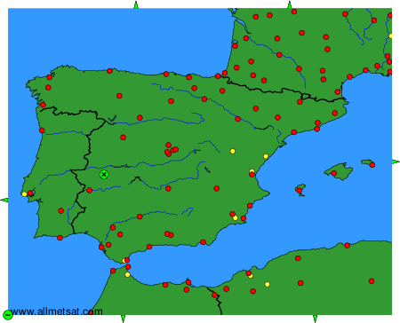
To change the map : click on the green buttons with a black cross to zoom in, on the green button with a dash to zoom out, or on the green arrows for adjacent maps.