METAR-TAF
Airports :
Altenstadt
Albenga
Alpnach
Altenstadt
Andora
Annecy
Augsburg
Aviano
Baden-Baden
Basel-Mulhouse
Bergamo
Berne
Bologna
Bolzano
Brescia
Brescia Ghedi
Buochs
Cannes
Cervia
Chambery / Aix-Les-Bains
Colmar
Cuneo
Dornbirn
Dübendorf
Emmen
Épinal
Ferrara
Florence
Forlì
Friedrichshafen
Frontone
Geneva
Genoa
Grenchen
Ingolstadt
Innsbruck
La Chaux-de-Fonds
Lahr
Laupheim
Lechfeld
Le Luc
Locarno
Lugano
Luxeuil-les-Bains
Meiringen
Memmingen
Metz-Nancy-Lorraine
Milan-Linate
Milan-Malpensa
Monte Cimone
Munich
Nancy-Essey
Nancy-Ochey
Neuburg
Nice
Novara
Oberpfaffenhofen
Padua
Paganella
Parma
Passo dei Giovi
Passo della Cisa
Passo Rolle
Payerne
Perugia
Piacenza
Pian Rosa
Pisa
Prato Nevoso
Resia Pass
Rimini
Salzburg
Sarzana
Sion
St. Gallen
St. Moritz
Strasbourg
Stuttgart
Toblach
Toulon
Treviso
Treviso
Turin-Aeritalia
Turin-Bric della Croce
Turin-Caselle
Venice
Verona
Zell am See
Zürich
Switzerland, Italy, North
Austria
Czech Republic
Europe
France
Germany
Italy
Slovenia
Altenstadt Air Base Altenstadt, Germany
latitude: 47-50N, longitude: 010-52E, elevation: 739 m
Current weather observation The report was made 1 hour and 0 minutes ago, at 02:20 UTC
Wind 25 kt from the West
Temperature -2 °C
Humidity 69 %
Pressure 1003 hPa
Visibility 10 km or more
METAR: ETHA 020220Z AUTO 28025KT 9999 // ////// M02/M07 Q1003 ///
Time: 04:20 (03:20 UTC) TAF: missing
Weather observations and forecasts of more than 4000 airports (METAR and TAF reports).
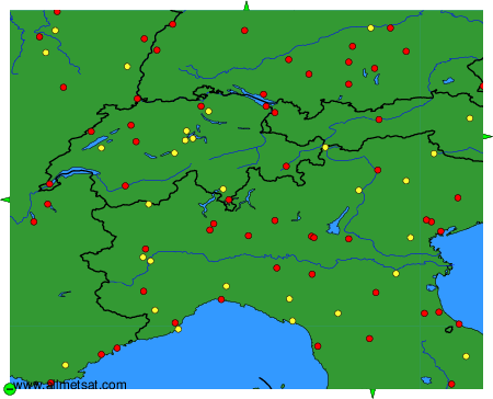
The available stations are represented by yellow and red dots on the map.
Hover mouse over dot to see the name of the station.
Then click to see weather observations and forecasts.
To change the map : click on the green buttons with a black cross to zoom in, on the green button with a dash to zoom out, or on the green arrows for adjacent maps.
