METAR-TAF
Airports :
Capitán de Corbeta Carlos A. Curbelo International Airport
Punta del Este, Uruguay
latitude: 34-52S, longitude: 055-06W, elevation: 30 m
Current weather observation
The report was made 33 minutes ago, at 18:00 UTC
Wind 15 kt from the West/Southwest
Temperature 15°C
Humidity 94%
Pressure 1010 hPa
Visibility: 3000 m
Broken clouds at a height of 400 ft
Broken clouds at a height of 800 ft
Overcast at a height of 2600 ft
Broken clouds at a height of 800 ft
Overcast at a height of 2600 ft
drizzle, mist
METAR: SULS 011800Z 25015KT 3000 DZ BR BKN004 BKN008 OVC026 15/14 Q1010
Time: 15:33 (18:33 UTC)
Forecast
The report was made 1 hour and 3 minutes ago, at 17:30 UTC
Forecast valid from 01 at 18 UTC to 02 at 18 UTC
Wind 10 kt from the West/Northwest
Visibility 10 km or more
Scattered clouds at a height of 1500 ft
Overcast at a height of 7000 ft
Overcast at a height of 7000 ft
Temporary
from 01 at 18 UTC to 01 at 23 UTC
from 01 at 18 UTC to 01 at 23 UTC
Visibility: 1200 m
Broken clouds at a height of 500 ft
Broken clouds at a height of 7000 ft
Broken clouds at a height of 7000 ft
drizzle, mist
Temporary
from 02 at 00 UTC to 02 at 12 UTC
from 02 at 00 UTC to 02 at 12 UTC
Visibility: 0800 m
Broken clouds at a height of 300 ft
fog
TAF: SULS 011730Z 0118/0218 30010KT 9999 SCT015 OVC070 TX18/0218Z TN11/0210Z TEMPO 0118/0123 1200 DZ BR BKN005 BKN070 TEMPO 0200/0212 0800 FG BKN003
Weather observations and forecasts of more than 4000 airports (METAR and TAF reports).
The available stations are represented by yellow and red dots on the map.
Hover mouse over dot to see the name of the station.
Then click to see weather observations and forecasts.
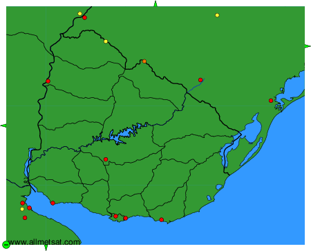
To change the map : click on the green buttons with a black cross to zoom in, on the green button with a dash to zoom out, or on the green arrows for adjacent maps.