METAR-TAF
Airports :
Rivera International Airport
Rivera, Uruguay
latitude: 30-53S, longitude: 055-32W, elevation: 205 m
Current weather observation
The report was made 32 minutes ago, at 05:00 UTC
Wind 1 kt from the West
Temperature 3°C
Humidity 100%
Pressure 1022 hPa
Visibility: 0100 m
fog
METAR: SURV 270500Z 27001KT 0100 FG NSC 03/03 Q1022
Time: 02:32 (05:32 UTC)
Forecast
The report was made 6 hours and 2 minutes ago, at 23:30 UTC
Forecast valid from 27 at 00 UTC to 27 at 24 UTC
Wind 3 kt from variable directions
Visibility: 3000 m
mist
Temporary
from 27 at 00 UTC to 27 at 12 UTC
from 27 at 00 UTC to 27 at 12 UTC
Visibility: 0600 m
Scattered clouds at a height of 800 ft
fog
Becoming
from 27 at 13 UTC to 27 at 15 UTC
from 27 at 13 UTC to 27 at 15 UTC
Visibility 10 km or more
Scattered clouds at a height of 1500 ft
Becoming
from 27 at 18 UTC to 27 at 24 UTC
from 27 at 18 UTC to 27 at 24 UTC
Broken clouds at a height of 1500 ft
Broken clouds at a height of 6000 ft
Broken clouds at a height of 6000 ft
TAF: SURV 262330Z 2700/2724 VRB03KT 3000 BR NSC TX17/2718Z TN02/2710Z TEMPO 2700/2712 0600 FG SCT008 BECMG 2713/2715 9999 SCT015 BECMG 2718/2724 BKN015 BKN060
Weather observations and forecasts of more than 4000 airports (METAR and TAF reports).
The available stations are represented by yellow and red dots on the map.
Hover mouse over dot to see the name of the station.
Then click to see weather observations and forecasts.
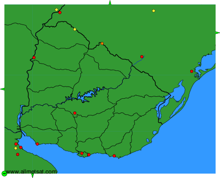
To change the map : click on the green buttons with a black cross to zoom in, on the green button with a dash to zoom out, or on the green arrows for adjacent maps.