METAR-TAF
Airports :
Vicecomodoro Ángel de la Paz Aragonés Airport
Santiago del Estero, Argentina
latitude: 27-46S, longitude: 064-18W, elevation: 198 m
Current weather observation
The report was made 19 minutes ago, at 10:00 UTC
Wind 2 kt from the North
Temperature -2°C
Humidity 86%
Pressure 1019 hPa
Visibility 10 km or more
no clouds below 1500 m and no cumulonimbus
METAR: SANE 071000Z 36002KT CAVOK M02/M04 Q1019
Time: 07:19 (10:19 UTC)
Forecast
The report was made 5 hours and 19 minutes ago, at 05:00 UTC
Forecast valid from 07 at 06 UTC to 08 at 06 UTC
Wind 3 kt from variable directions
Visibility 10 km or more
no clouds below 1500 m and no cumulonimbus
Becoming
from 07 at 09 UTC to 07 at 12 UTC
from 07 at 09 UTC to 07 at 12 UTC
Wind 10 kt from the North
Becoming
from 07 at 15 UTC to 07 at 18 UTC
from 07 at 15 UTC to 07 at 18 UTC
Wind 15 kt from the Northeast with gusts up to 25 kt
Becoming
from 08 at 00 UTC to 08 at 03 UTC
from 08 at 00 UTC to 08 at 03 UTC
Wind 10 kt from the North/Northeast
TAF: SANE 070500Z 0706/0806 VRB03KT CAVOK TX19/0718Z TN02/0710Z BECMG 0709/0712 01010KT BECMG 0715/0718 04015G25KT BECMG 0800/0803 03010KT
Weather observations and forecasts of more than 4000 airports (METAR and TAF reports).
The available stations are represented by yellow and red dots on the map.
Hover mouse over dot to see the name of the station.
Then click to see weather observations and forecasts.
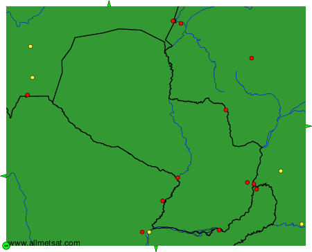
To change the map : click on the green buttons with a black cross to zoom in, on the green button with a dash to zoom out, or on the green arrows for adjacent maps.